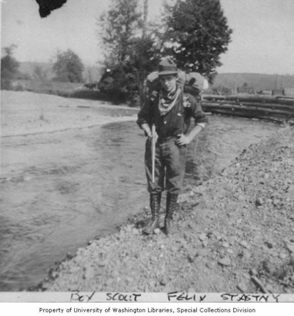
A few weeks after Boy Scouts started in Seattle, 120 boys and their leaders took the first Scout hike adventure from Ballard to the Arboretum on September 10, 1910.
I recently took my own history hike from Ballard to the Arboretum. I’ll share what I know and guess about their hike, and how you can enjoy my hike or your own variation.
The P-I’s description of the first Scout Hike
“One hundred and twenty boys have already been recruited in Ballard, and will this morning participate in a cross-country hike to Washington park [arboretum]. Today’s outing will be in charge of Scout Masters B. A. Clark, of Ballard; P. J. Flagg, of Rogers [playfield], and H. A. Anderson, of Collins [playfield].
“At the park a detail of lads will concert themselves in the woods, leaving a trail purposely marked with conflicting signs, and the boys will endeavor to find them. The Ballard division consists of fifty boys, the Collins of thirty-five and the Rogers of thirty-five.
“At present time there are nearly 300 lads connected directly or indirectly with the boy scout movement in Seattle.”
– September 10, 1910 Seattle Post-Intelligencer
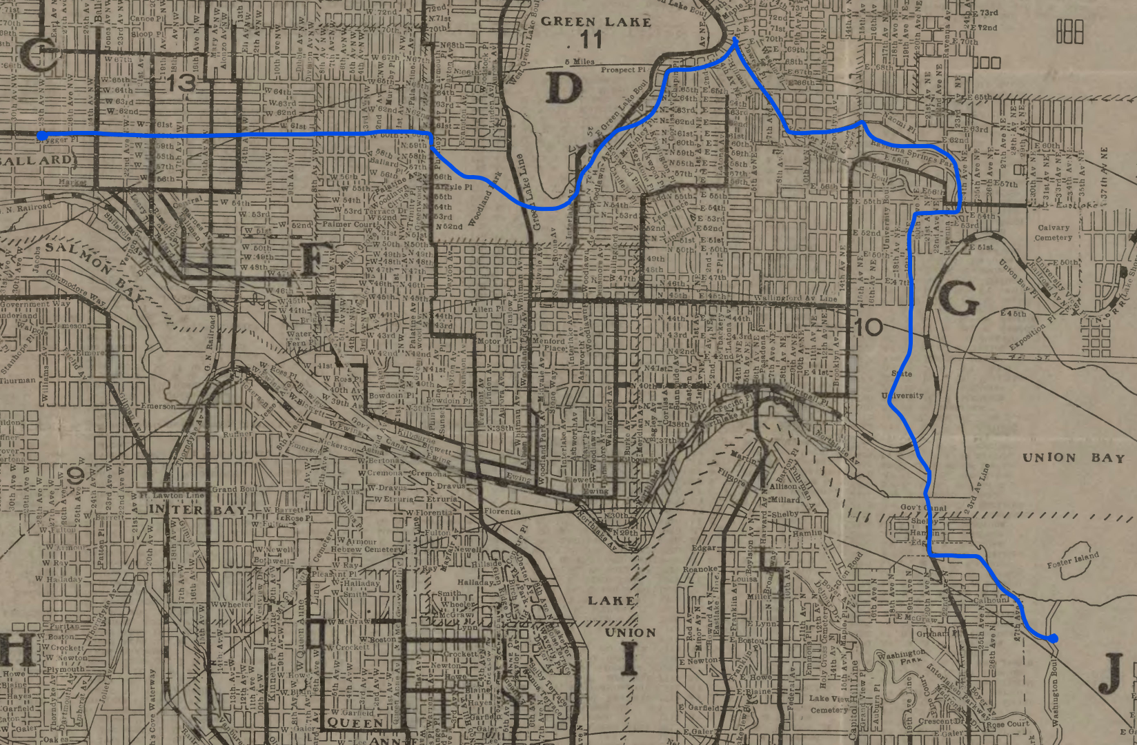
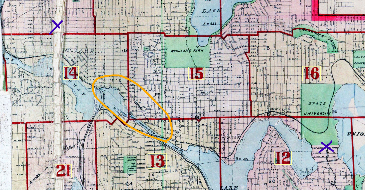
The likely route of the first Scout hike
Where did they walk? Here is a simple, most likely answer:
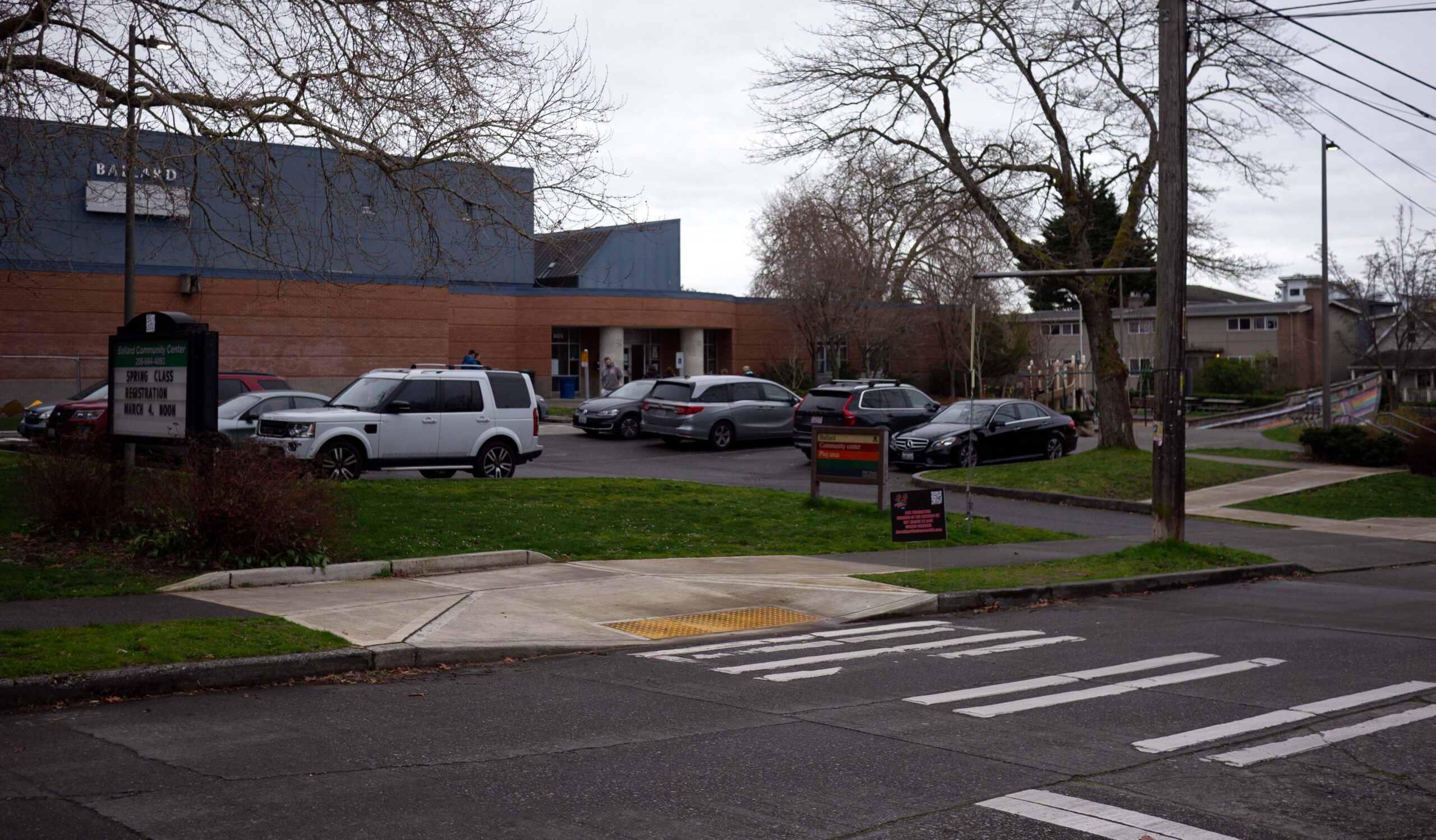
- Started at Ballard Fieldhouse, now Ballard Community Center
- To and through Woodland Park, now Woodland Park Zoo
- Along east edge of Green Lake (not a park yet) to new Ravenna Boulevard
- On Ravenna Boulevard to Ravenna Park
- Through Ravenna Park, then on 22nd to the new UW campus
- Through UW campus and down Cascades (SE from Drumheller Fountain)
- Along Montlake Boulevard over a temporary suspension bridge over initial phase of Montlake Cut
- Across bridge over remainder of original Portage canal
- East on Montlake Boulevard to Washington Park (not yet Arboretum) to play trail-sign hide and seek
Here is an approximate route you can hike on today’s roads and parks, on AllTrails.
The first Scout hike’s troops
Three of the fist troops in Seattle met at city playfields: Ballard, Rogers, and Collins. The founders of Scouting in Seattle were a cross-section of every group interested in youth enrichment, including the city’s parks department. The city Superintendent of Playgrounds, J. H. Stine, was the elected leader of Seattle Scouting. I wrote an article about this early period of Scouting in Seattle, which was an eight month blank spot in HistoryLink’s Chief Seattle Council history.
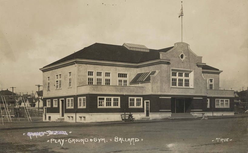
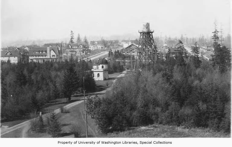
Ballard Playground sits next to Adams Elementary School today, just as it did in 1910. After the idea of active parks — city playgrounds and playfields — was introduced in the 1903 Olmsted Plan for Seattle, they were rapidly built across the city and are still a repeating pattern next to elementary schools. Rogers Playground was next to Seward School, now TOPS K-8. Collins Playfield was a free-standing park, now Wisteria Park, part of Seattle Buddhist Church.
After Adams Elementary was completed in 1909, the playfield and fieldhouse (referred to as a “gym” in the SPL photo included here) were completed in 1910. The fieldhouse allowed activities at night and on rainy days, and hosted a park Scout troop. According to the Seattle Public Schools history Building for Learning, Adams Elementary students collected saplings for Arbor Day in 1910 and planted them around the edge of the park and school. So we can see huge trees today that were just saplings when the Scouts hiked later in the year.
The route of Seattle’s first Scout hike
The article described the start and end of the hike: (a) Ballard Playfield (now Ballard Community Center); and (b) Washington Park (now Washington Park Arboretum, or The Arboretum).
It’s easy to find a good route between the two. For example, I walked the Burke-Gilman recently with a friend on my first reenactment of their hike. But over the last 115 years there have been so many changes to our city that we need to do some serious research to figure out where they might have hiked.
The first question to answer: how did they get across the Ship Canal from north to south?
The second, how did they get to that crossing?
And finally, how did they get from the crossing to (currently) the Arboretum?
They crossed at Montlake in 1910
None of our current crossings or bridges existed in 1910: Ballard Locks (1917); Ballard/15th (1949); Fremont (1917); Aurora/George Washington (1932); University (1919); nor Montlake (1925).
In 1910 there were crossings at 14th Ave (City of Ballard’s Railroad Ave until 1907) across Salmon Bay; a small bridge at 3rd Ave NW; a bridge at Fremont; the “Brooklyn Bridge” on 7th Ave NE to Brooklyn (now University District); and a new pedestrian-only suspension bridge at Montlake. Note that the Stone Avenue Bridge, temporary replacement for Fremont’s bridge, did not open until Spring 1911.
It’s strangely difficult to understand these crossings. Since they don’t exist anymore, no one talks about them or has talked about them in a hundred years in some cases. I still don’t understand the 3rd Ave NW crossing: was it for streetcars only? Could people walk across it? But it doesn’t really matter for our purposes. Crossing in Fremont would cause an unnecessary and unattractive detour south around Lake Union. Westlake Avenue was a smaller road and not yet in its current form. That narrows the possibilities to Brooklyn (now University Bridge) or Montlake.
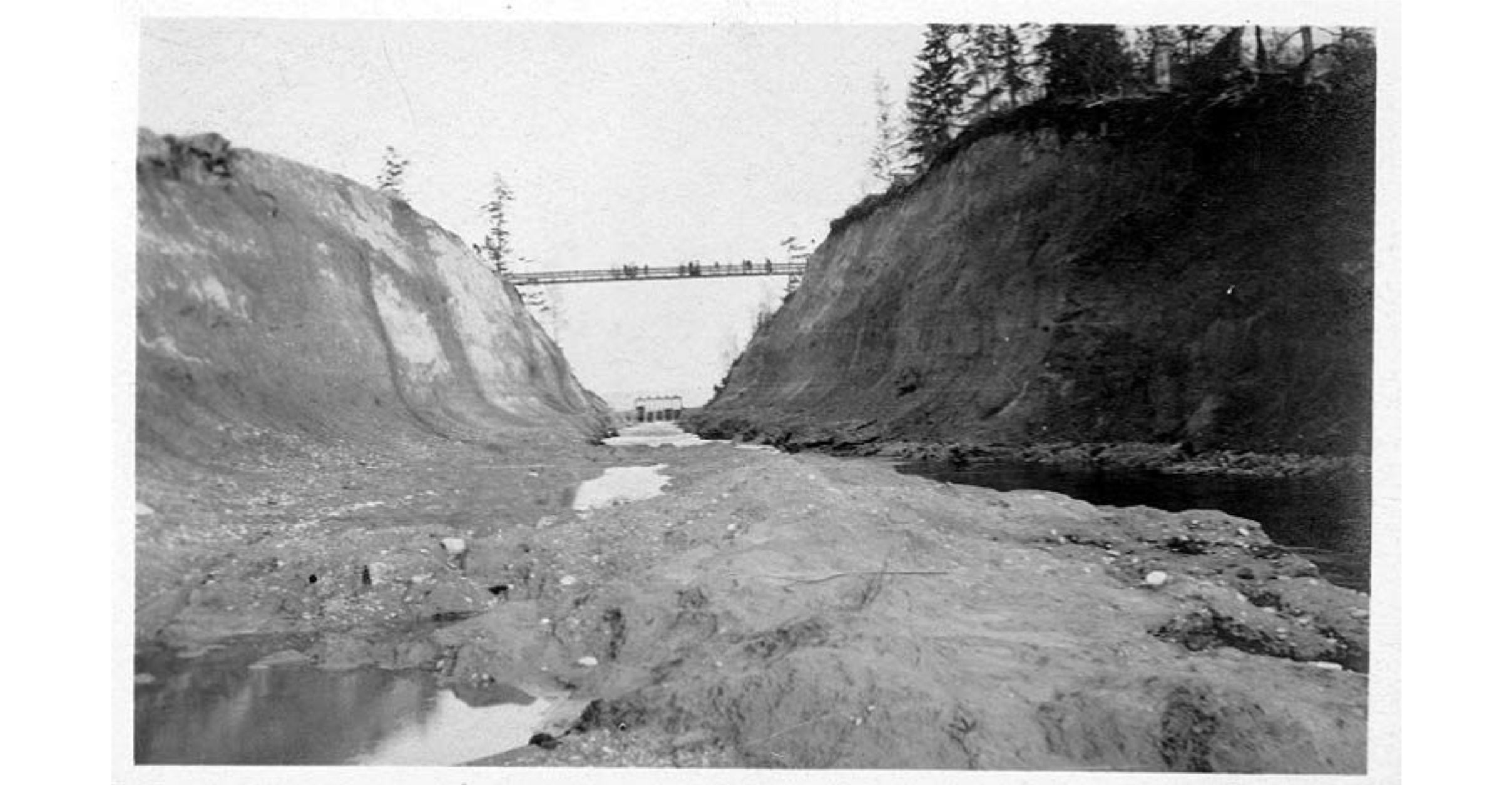
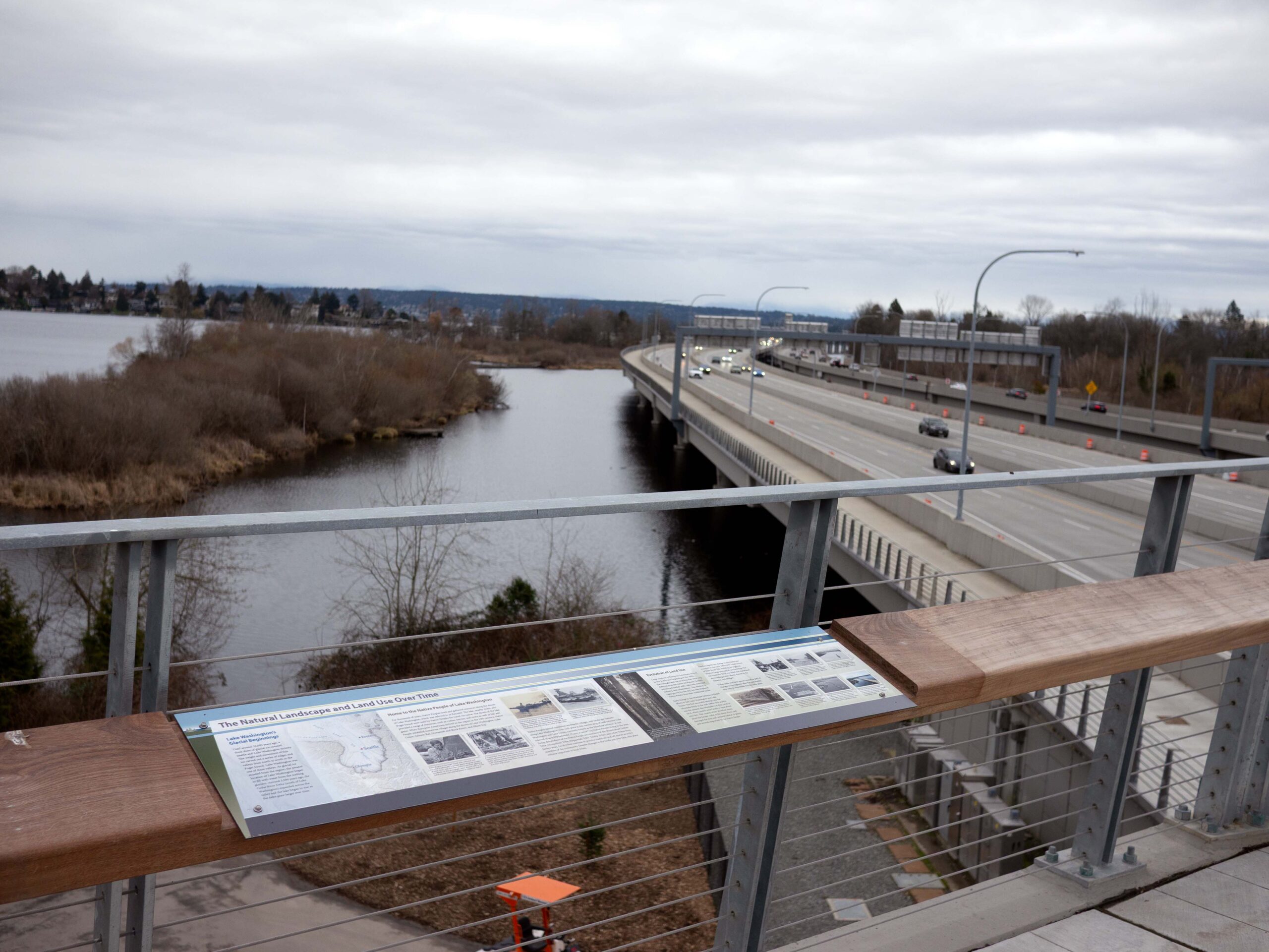
After digging around quite a bit, I discovered that the Montlake Cut began right after the 1909 Alaska Yukon Pacific Exposition. And to allow people across, a temporary foot and bike suspension bridge was built in May 1910, which lasted until May 1912. Just a few months old, that bridge would be a fantastic experience for young hikers, and I’m confident it was the real highlight of the hike.
While researching the suspension bridge, I put together a complete timeline of Montlake crossings and wrote that for this site.
So, how did they get from Ballard Community Center to the Montlake Bridge?
Burke-Gilman did not exist in 1910
They didn’t hike the Burke-Gilman, of course. The bike and ped recreation path was started in 1976 eastward from Gasworks Park. I’ve read about young people taking long distance hikes on rail lines, for example to Everett overnight on an interurban line. But our hikers didn’t do that. Because the Burke-Gilman’s predecessor rail line didn’t exist yet. For decades we’ve been talking about a short “missing link” for the Burke-Gilman in Ballard, but back in 1910 there was a long gap in the rails from Fremont to Ballard with no rail on the north side of the canal and Salmon Bay.
Seattle filled this gap in 1912 and 1913 as part of the construction of the Lake Union Belt Line, also continuing tracks down the west side of Lake Union on Westlake.
The Burke-Gilman is a great route today. In fact, it’s what I walked and one I would recommend. But not 1910.
An all park route for Seattle’s first Scout hike
If it were me in 1910, I would walk through as many parks as I could.
Today, the route should include Woodland Park Zoo, maybe stopping to see the animals. Perhaps an organized hike could get a discount walk through the zoo, and have an east gate opened? Then the hike proceeds around Green Lake on the south, along Ravenna Boulevard over to and through Ravenna Park, trough the UW campus, over the new Montlake lid to the Arboretum.
Back then, Green Lake’s encircling park didn’t exist yet. The lake was lowered 7 feet in a 1911 plan by Olmstead Brothers to create the park. I’m not positive, but I believe Ravenna Boulevard already connected the east edge of the lake with Ravenna Park, so I propose that route after skirting the south edge.
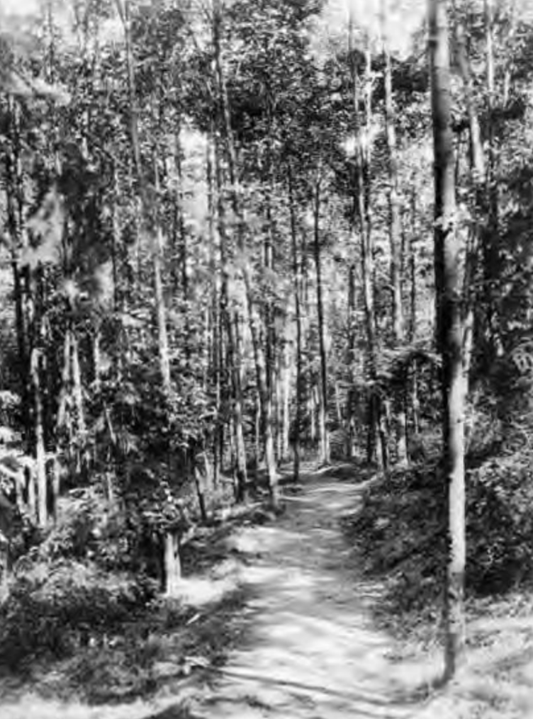
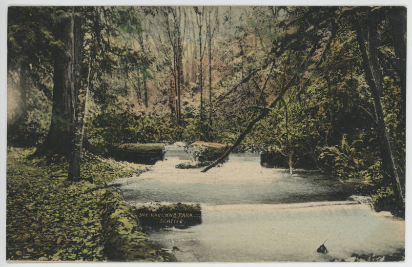
Ravenna Park had a nickname “Big Tree Park”, making a great cut through to the sprawling university campus. The campus was wide open, after development and tear down for the Alaska Yukon Pacific Exposition. Most of the expo was temporary, but they saw some remaining structures like the Women’s Building, Fine Arts Palace, Hoo-Hoo House, and Forestry Building.
After exiting the campus on the Cascades, now an unnamed road leading from Drumheller Fountain to Pacific Avenue, they made their way to the Montlake suspension bridge.
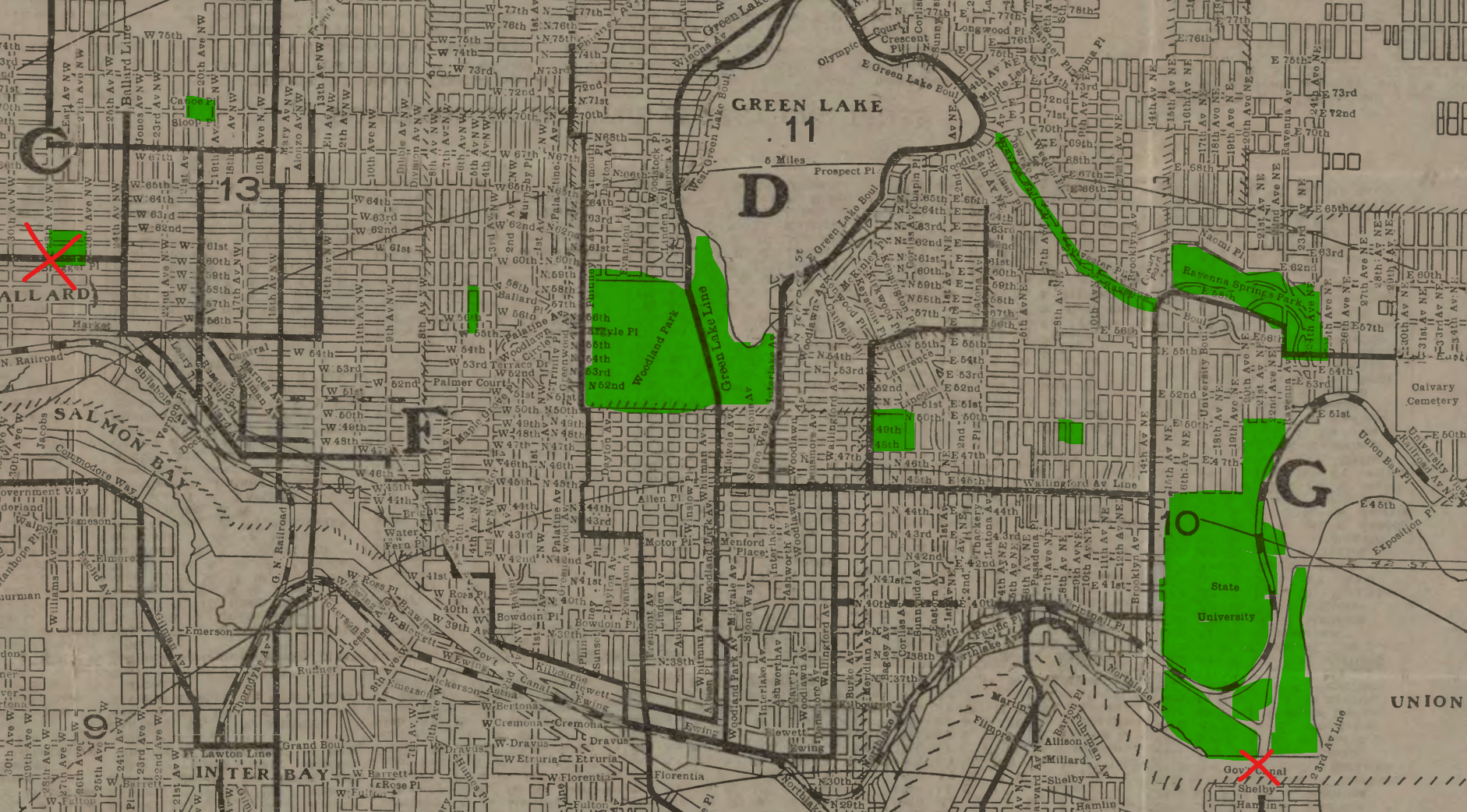
The first Scout hike through Montlake
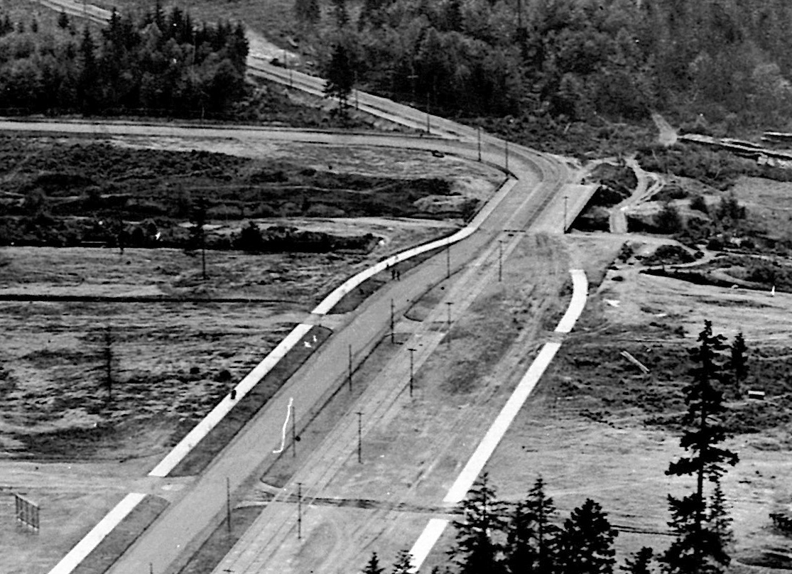
After using the suspension bridge to cross and perhaps watch construction of the Montlake Cut, they passed the as-yet-undeveloped Montlake Park Addition. Then they crossed a new 1909 road and streetcar bridge over the old Portage canal.
The Portage canal was an attractive route eastward to the water, alongside the new Montlake Boulevard (now East Lake Washington Boulevard). Perhaps there was a lakeside path into Washington Park, or else they took Washington Boulevard (also now East Lake Washington Boulevard).
The Washington Park Arboretum, which we just call “The Arboretum”, wasn’t an arboretum yet in 1910. That started in the 1930s. When the hike happened it was just “Washington Park”. After the land was logged it became a city park in 1900. There are many news reports of Scout visits in the 1910s and 1920s, so it must have been quite wild. Some of those might have been to what is now the golf course. That was undeveloped land still owned by Puget Mill Company, way over to 37th. Beyond that was the “Western Washington Fairgrounds” at Madison Park.
Alternate routes
Marsh Island and Foster Island
From the Montlake Bridge a hike could cover the Arboretum Waterfront Trail and Foster Point Trail.
Foster Island was truly an island back then, not just a swampy mess. Marsh Island didn’t appear on maps at all in the 1910s and the first mentioned in the Seattle Times was in 1965 in lowercase. The water level dropped 15 feet when the Montlake Canal opened, connecting the small island to the mainland with mud. Some fill was done after 520 construction in the mid-1960s, raising their level a bit.
With rubber boots or in the right season, the trail across Marsh Island and Foster Island would be a fun conclusion to a hike from Ballard, but it’s not historic.
A streetcar route
A streetcar history hike could take mostly ghost streetcar tracks from Ballard Community Center to Montlake.
Tracks were on 60th to 24th, then down 24th to Ballard Ave. Leary Way did not yet connect Ballard and Fremont, so after Ballard Ave the route looks a bit jagged now. It went on 47th, 8th, 46th, 6th, 41st, 3rd, then angled on Kilbourne (now 36th), and turned on Evanston, and Ewing (now 34th). Tracks exited Fremont on Ewing (now 34th), turned north on Wallingford, and east on 40th. The route departs streetcar tracks at 15th Ave NE, crossing UW campus to Drumheller Fountain and then continuing on the park route described above.
A direct route
The most direct route heads along 60th to 24th, down 24th to Ballard Ave, angles on Ballard Ave to 45th, up 45th on stairs to Aurora, under Aurora at 46th, back to 45th and east to UW campus, through campus to Montlake.
Then continue on the same path as the park route or perhaps south on Montlake Boulevard a bit until heading east into the Arboretum.
Burke-Gilman Trail
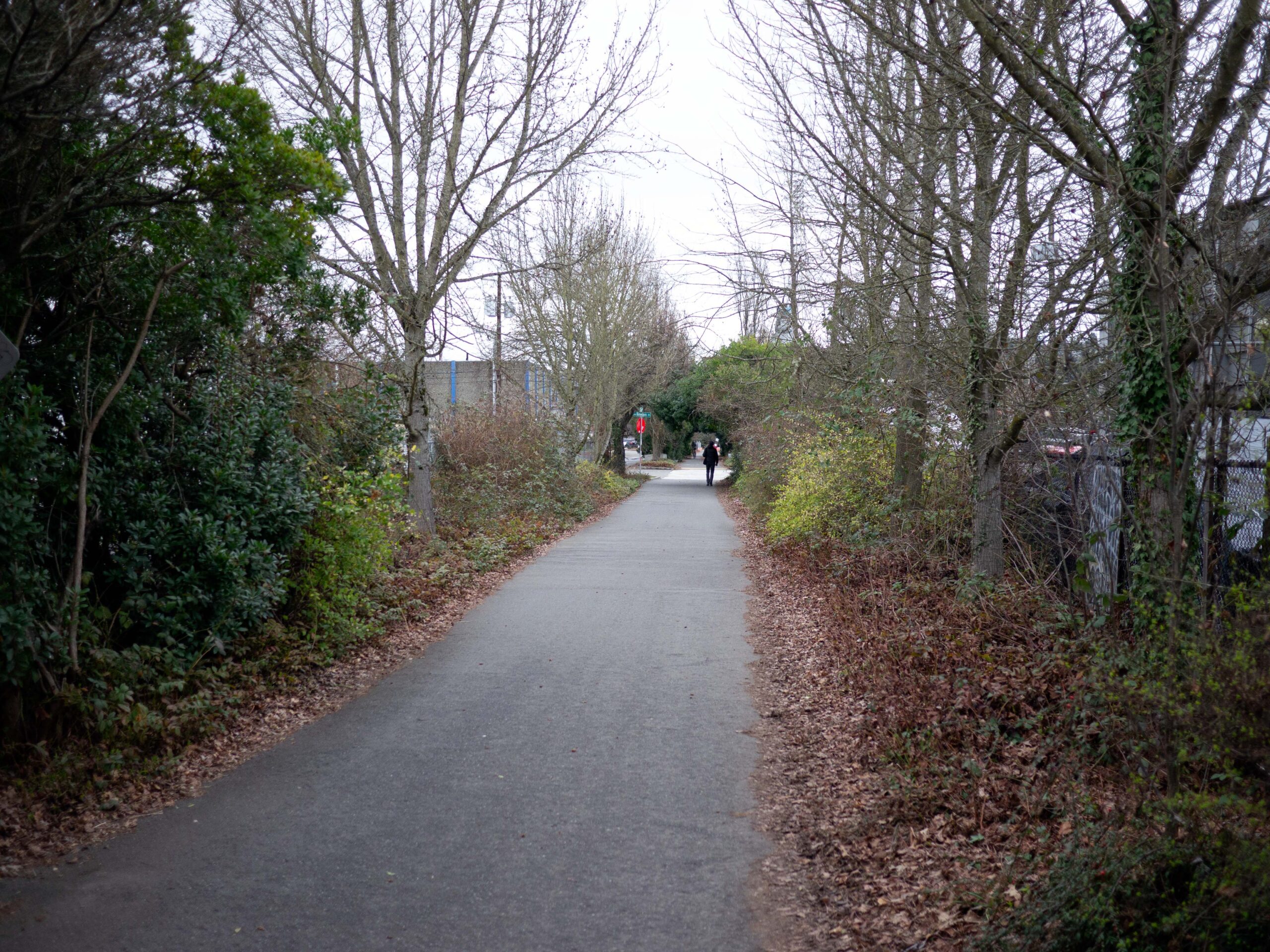
A fantastic route – the one I took initially – uses the Burke-Gilman Trail for most of the trip from the Ballard Community Center to the Arboretum.
First you need to get to the trail, which ends at the Ballard Locks and then restarts near Fred Meyer. I chose to walk on 60th to 24th, then south to Market Street. I crossed and headed southeast on Ballard Avenue. Ballard Avenue is a historic district, and there are a number of signs describing the history of buildings along the way. Also there are several outfitters along the way like Filson (no longer a Seattle company) and Kavu (still a Seattle company).
I headed east on 46th, seeing the “Up House” east of 15th and the engine pen for Ballard Terminal Railroad east of 14th. Then, I headed south on 11th a block to the start of the Burke-Gilman Trail. I left the trail at Pacific Place on the south end of UW campus. Next I crossed Pacific and Montlake Boulevard using took the new light rail station bridges, ending up on the east side of Montlake. After crossing the Montlake Bridge I turned on Shelby, then went up and over 520 on the new lid crossing with eastward viewpoint. After walking along Lake Washington Boulevard I entered the Arboretum and returned to my car, which I left before bussing to Ballard.
Burke-Gilman background
The Burke-Gilman west of Gasworks was built in the early 1990s. The section east of Gasworks was built in the mid-1970s. The trail itself follows former Northern Pacific Railway lines. NP reconfigured lines and built a new bridge at 41st (now removed) in 1913 in preparation for the 1916 release of Lake Washington and 1917 opening of the Ballard Locks.
Prior to that, the rail line crossed at 34th, and you get a sense of it by the change in atmosphere at the intersection of Canal St, Phinney Ave, 34th St, and Northlake Way.
Side trips
There are many cycling and outdoor companies on and nearby the trail in Ballard, Fremont, and Wallingford. These include but are not limited to Cycle & Coffee, Wonderland, Cripple Creek Backcountry/Basalt Bikes, Wright Brothers, Free Range Cycles, Cascade Bicycle Studio, Davidson, Mischief, Evo, Brooks, Black Diamond, Urban Surf, and Recycled Cycles. There are even more cafes.
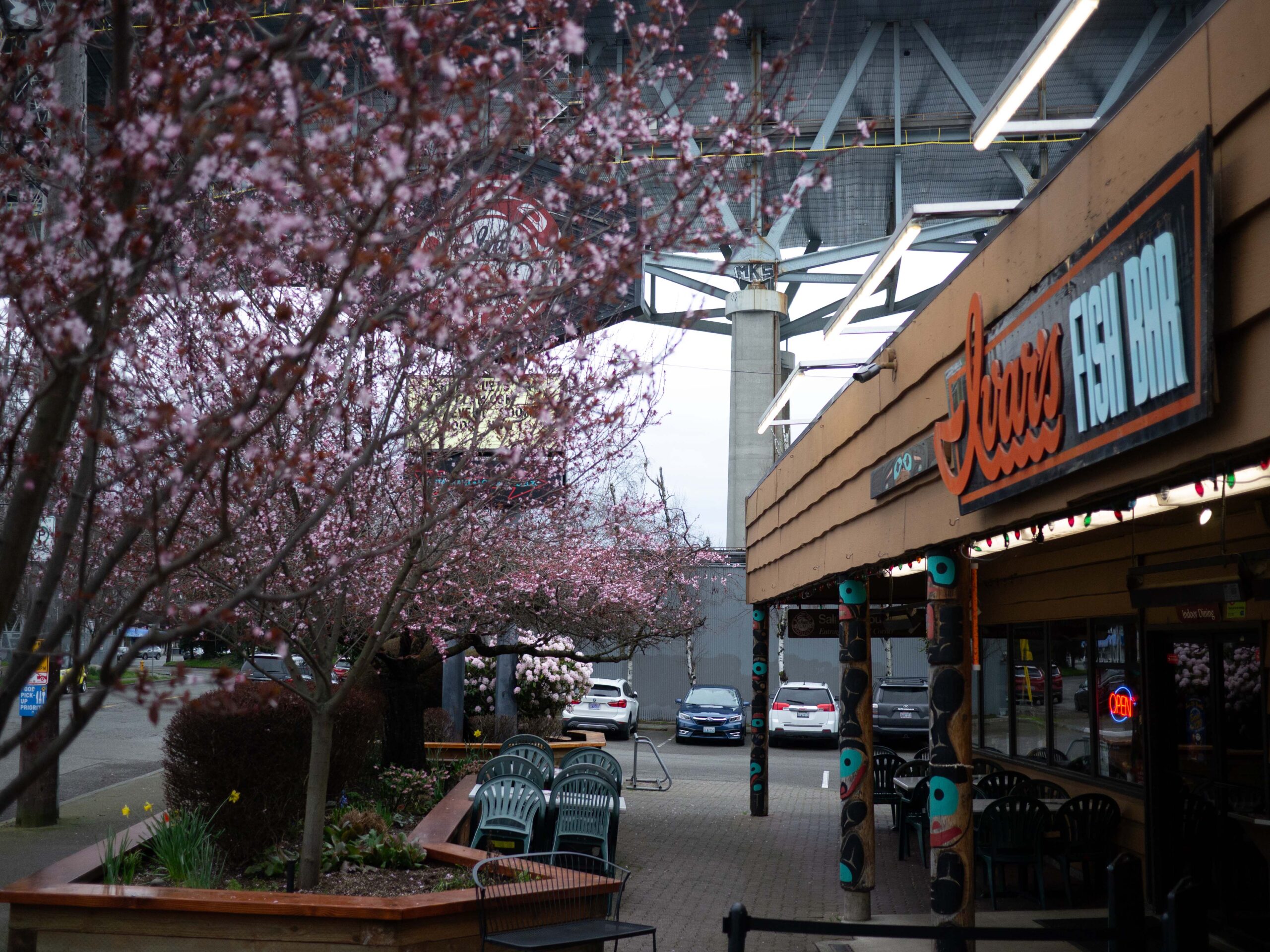
Side trips could visit the J. P. Patches statue or troll monument in Fremont, ice cream or popsicle stores, an arcade, Dick’s Drive-In, Ivar’s and a host of other landmarks. These sorts of stops really differentiate urban hiking from being in the backcountry and show its unique value.
On my trip, a friend and I stopped for a short break at a Stone Way cafe, poked our heads in at Evo across the street, and for a cup of clam nectar at Ivar’s. All were welcome on a cold late winter day.
Our hike covered 8 miles from the community center to the Arboretum.
More I wrote
My articles on early Seattle Scouting:
- Seattle’s second Scout hike
- Seattle’s first patrol leaders
- Start of Scouting in Seattle
- Elmer Katayama at Camp Parson’s opening
- George Nakashima and Scouting
- Aldus Hoopman, Seattle’s first Eagle Scout
- Troop 50 to 59
My articles on early Seattle Cub Scouting:
- Cub Scouts began in Port Angeles (part 1)
- Camp DYB, 1925 Cub camp in Port Angeles (part 2)
- Wolf Cubs lost at war (part 3)
- Blue Ox Camp, Seattle’s Paul Bunyan themed camp (part 4)
- What did they sing at Blue Ox Camp? (part 5)
- Cub Scout Alphabet
More walks:
- Aoi Bridge and Tamagawa Aqueduct walk
- Walking off into the Sunset: a history hike of landmarks in Seattle’s Capitol Hill neighborhood reviewing the book Seattle Walks (Capitol Hill Seattle Blog)
- Photos on walks in Tokyo from 2000-2008. In particular I’ll highlight Streetcar Memories, describing the route of the number 38 Jyoto-sen toden streetcar; Walk to Work 4, from Higashi-Koenji to Shinjuku; and Urban River Cycling, from Mitaka to Akasaka-Mitsuke.
Discover more from ba-kground
Subscribe to get the latest posts sent to your email.