Recently I took a pleasant walk on the former Tamagawa Aqueduct, from Shinjuku to Sasazuka. Previously I wrote part one, describing my starting point at Aoi Bridge and the aqueduct to Yotsuya. So now it’s time to discuss the route.
To me, the best walks are endless. Before the actual walk, the walk begins with some inspiration, and research of the route and things to see. Along the way, things are seen, recorded, photographed, and researched realtime. I used to stop at convenience stores to look at a map when I got turned around, but now that’s all on my phone of course. Particular to walks in Japan, I used to carry an electronic dictionary and look up signs I didn’t understand. Now I can simply select the text in a photo and send it to a translation site, or hazard the live translation (which burns battery and isn’t usually as good).
Walks can go on long afterwards, too. This one led me to learn much more about the aqueduct than I knew before. Additionally, I later learned the specifics of the Keio Line’s history on these streets. I didn’t even know I was walking rail history. It was strange to be a part of future history, too. I arrived at the information center for the greenway’s redevelopment within an hour or two of it opening the first time. And I stumbled upon and through a press conference for the project’s urban renewal.
I want to be clear that I am not sharing this to feign that I walked with this awareness. And I know there are real problems: some of it is wrong; I talk about things that are not photographed; and there is so much more to be learned. I’m simply sharing this to enrich the before or after of your next walk and to bridge to my next visit.
Aoi Street’s signs of Tamagawa Aqueduct
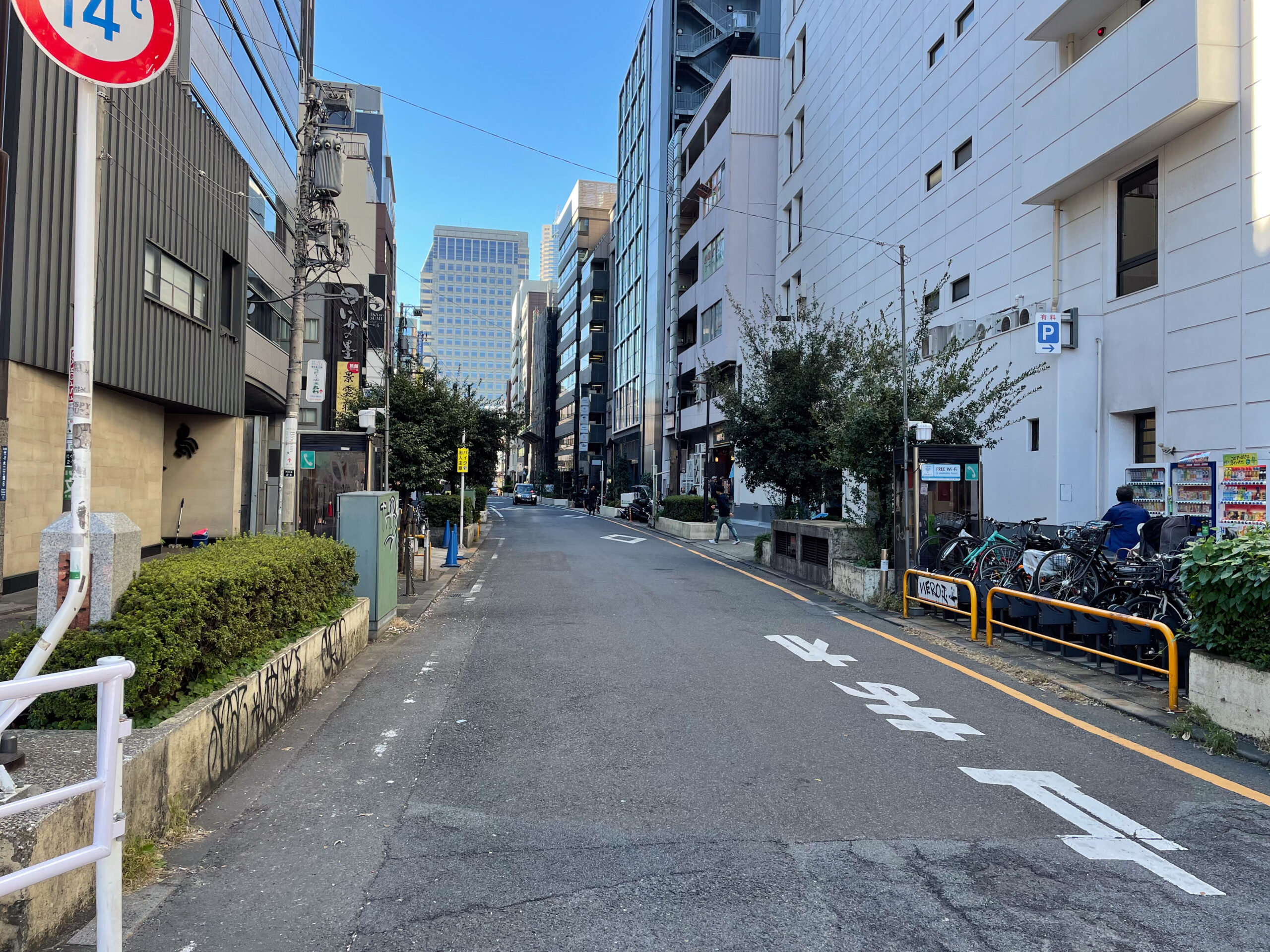
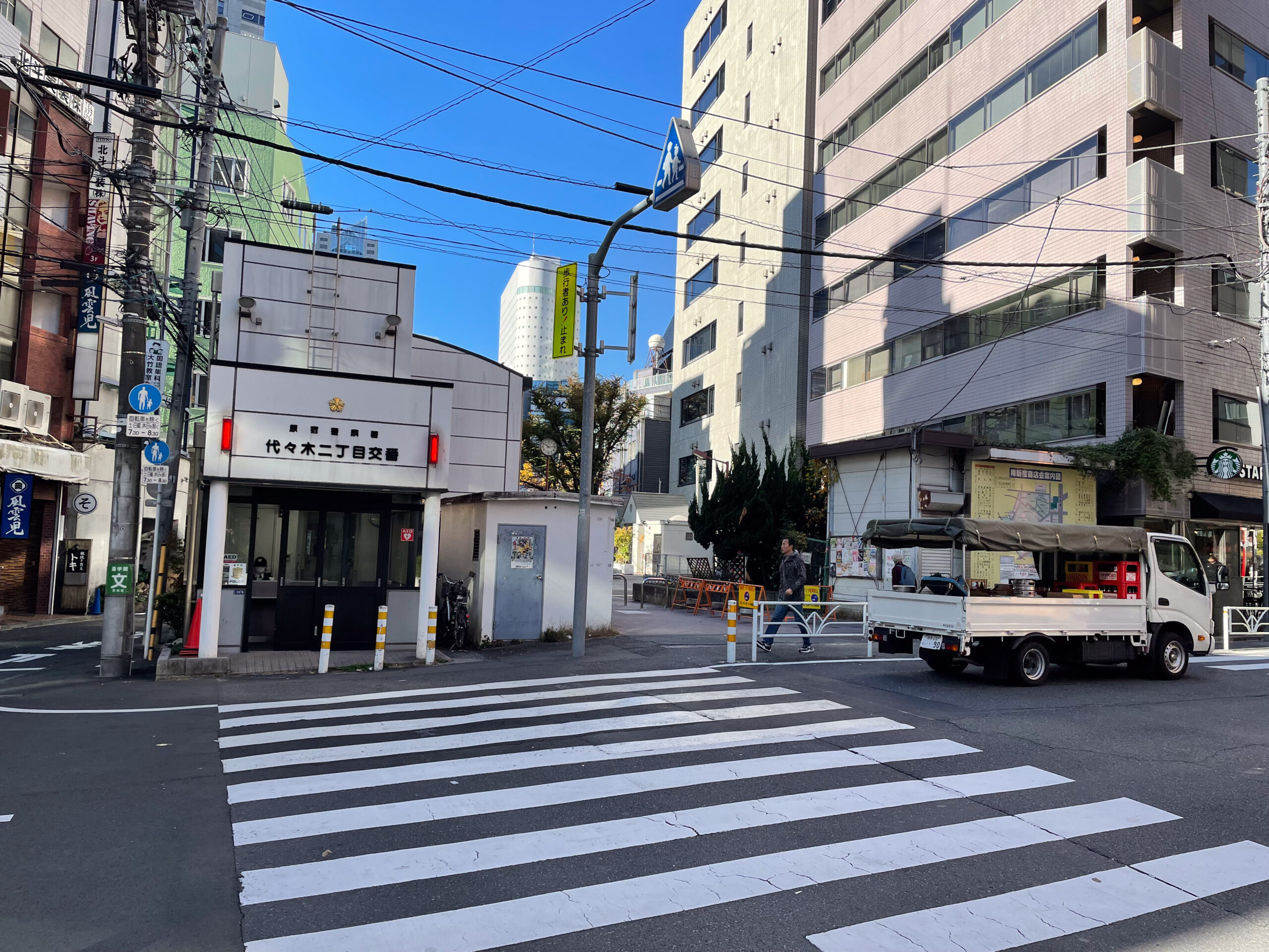
Heading west from Aoi Bridge (Aoibashi 葵橋), I started my walk on Aoi Street. As I wrote, aoi here is not blue. Instead it is the homonym hollyhock. It’s named after the symbol for the Tokugawa family, which had an estate just to the south in the late 1800s. Because it was once the Tamagawa Aqueduct, the road is wider than other nearby side streets. So in addition to two car lanes, you’ll find planters, bicycle and motorcycle parking, wide sidewalks, community bulletin boards, street trees, vents, electrical boxes and even a phone booth or two on the way to Yoyogi 2 Police Box at the former Sendagaya Bridge.
Among the objects along the street, there are an array of different types of signs. Right at the start, next to McDonald’s there is a “14t” sign, limiting vehicles to no more than 14 tons. Normally you’d find this sort of sign on an old bridge. Like many street signs in Tokyo, it’s clustered here alongside others. It has a no parking, a speed limit 30kph, and a rare “no buses or trucks next 230m” sign. Along with a drainage pipe for the remnant of the canal, the Keio Line subway is just below your feet here. I guess it’s not very deep, and the 60-year-old lid on top of it is essentially a weak bridge.
Sendagaya, second bridge on Tamagawa Aqueduct
On the far end of Aoi Street, 230 meters away, there are markers for Sendagaya Bridge.
Sendagaya Bridge provided the only access in this area from the Koshu Highway across the canal until the late 1800s, leading to the village of Sendagaya. Today this is disorienting to me because Sendagaya Bridge is well outside of Shibuya’s Sendagaya addresses and a half hour walk west of JR Sendagaya station.
Tamagawa Aqueduct channeled Edo and then Tokyo’s drinking water for several hundred years. In 1898 it was cut off at Daitabashi and piped to the new Yodobashi Purification Plant. The plant left a rectangle that is now the grid of west Shinjuku.
So the area I walked hasn’t carried drinking water — except in emergencies after two 1920s earthquakes, and to the Mita Canal — in a very long time. After drinking water was diverted from this section of the aqueduct in 1898, a deep ditch remained. It carried rainwater and drainage.
Lined with trees and a street on each side, the former aqueduct split the growing neighborhood. Some of the bridges like Sendagaya perhaps were centuries old. But new, smaller bridges like Aoi Bridge spanned with increasing frequency. It’s safe to imagine one at every new crossing.
Keio tunnel remnant
I walked the area around Bunka Gakuen a few times. You might want to zigzag the area west of Yoyogi 2 Police Box to see the areas on both sides of it. North of the box is the route of the aqueduct. South of it is a road at a lower grade. That road was the exit of the Keio Line subway in 1963.
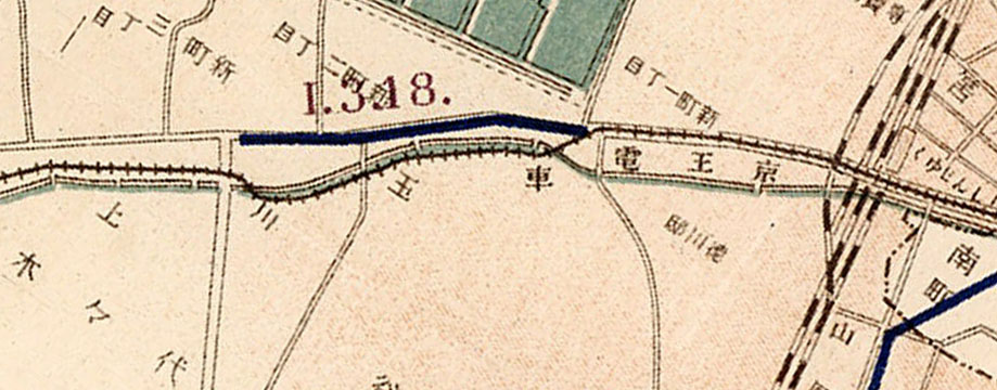
In 1915, the Keio Line originally used the former Tamagawa Aqueduct right of way from Hatsudai to just west of Shinjuku. With water diverted at Daitabashi, the Bureau of Waterworks no longer needed the aqueduct’s space. So the ditch with the old water made space for the Keio Line. Presumably that careful, curvy construction is what delayed opening the line from Sasazuka eastward for two years. The small access road at Nishi Shinjuku 2 intersection is where the line merged back onto Koshu Highway like a streetcar. In 1936, the aqueduct was finally pushed into a pipe under the Keio Line.
The lower, southern road here between Aoi Street and Bunka Gakuen is a later remnant of interplay between the railway and aqueduct. It’s from the 1963 opening of the tunnel to Shinjuku. This temporary rail tunnel entrance to the underground Shinjuku station skipped the shared track. Just a year later, subway construction completion to Hatsudai made the exit unneeded.
Take the Keio Line back from Sasazuka and you’ll go under this section. If you take the Keio New Line, you’ll instead stay under Koshu Highway and go to its terminal station.
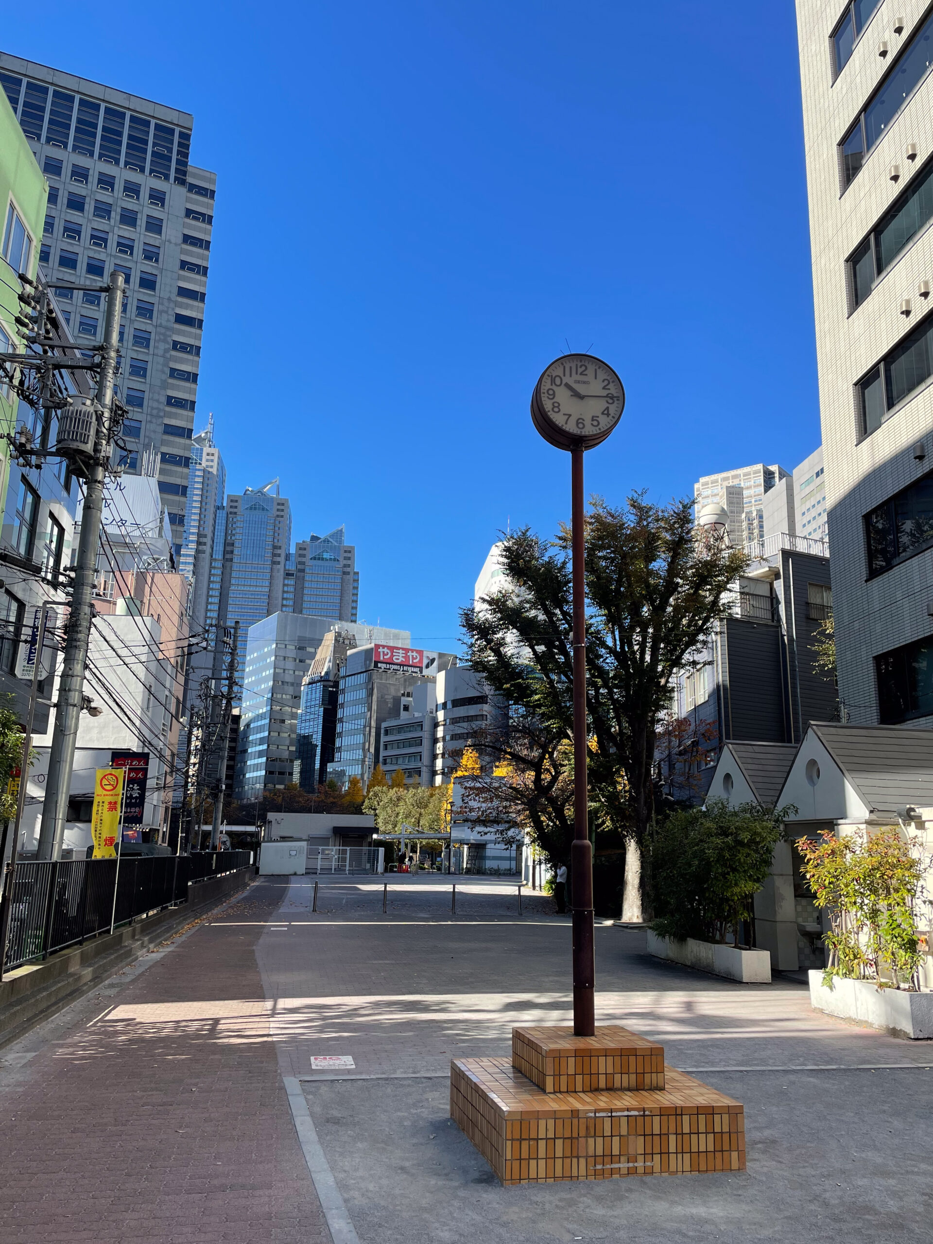
Bunka Gakuen and the Tamagawa Aqueduct memorial
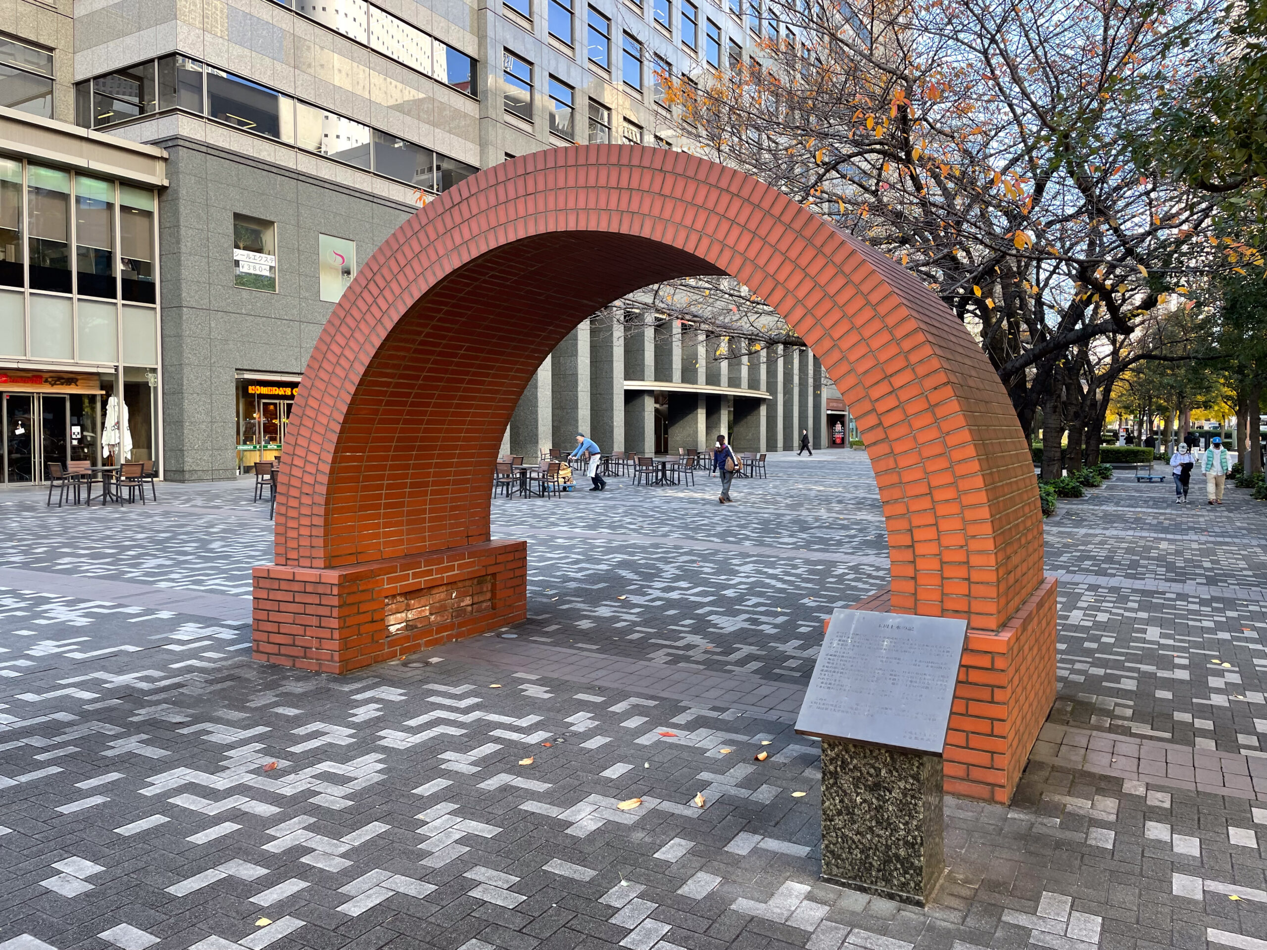
The arch in front of Bunka Gakuen is a monument to the Tamagawa canal. It’s a sectional recreation of the brick tunnel that carried water from Aoi Bridge towards Yotsuya under the tracks of Shinjuku Station. The memorial was built in 2003 by the Tokyo Bureau of Waterworks.
The sign next to it starts with the same text as the one that hung in Shinjuku South Building, which I described in the Aoi Bridge article. On the inside bottom, somewhat protected from the elements, you can see some of the original bricks recovered from the tunnel.
The arch is above the canal’s course. After the memorial arch, along the street edge next to the bus stop there is a historical marker for Nakoso Bridge.
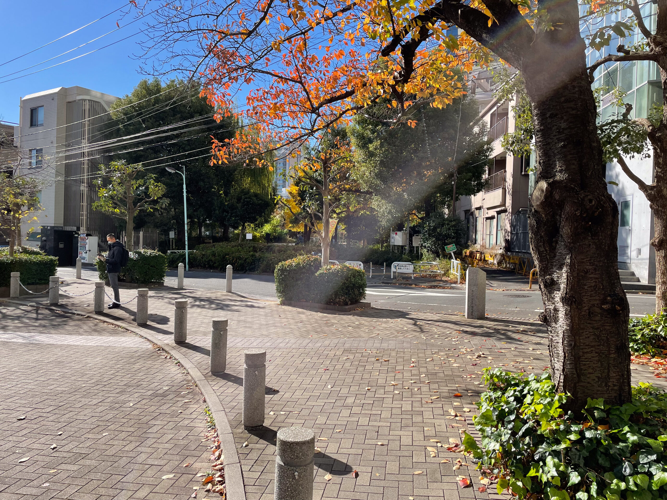
It continues in the narrowing plaza between the school and Koshu Highway. Then our canal heads along the school in the parking access road south of a wedge of buildings. As the parking turns away, the canal crosses under former Tenjin Bridge and enters the Yoyogi Greenway. On the near side there’s a granite marker for Tenjin Bridge, and on the far side there’s an interpretive sign from the Shibuya Education Center describing Tamagawa Aqueduct’s history.
Yoyogi Greenway: Tenjin Bridge to Nishisando
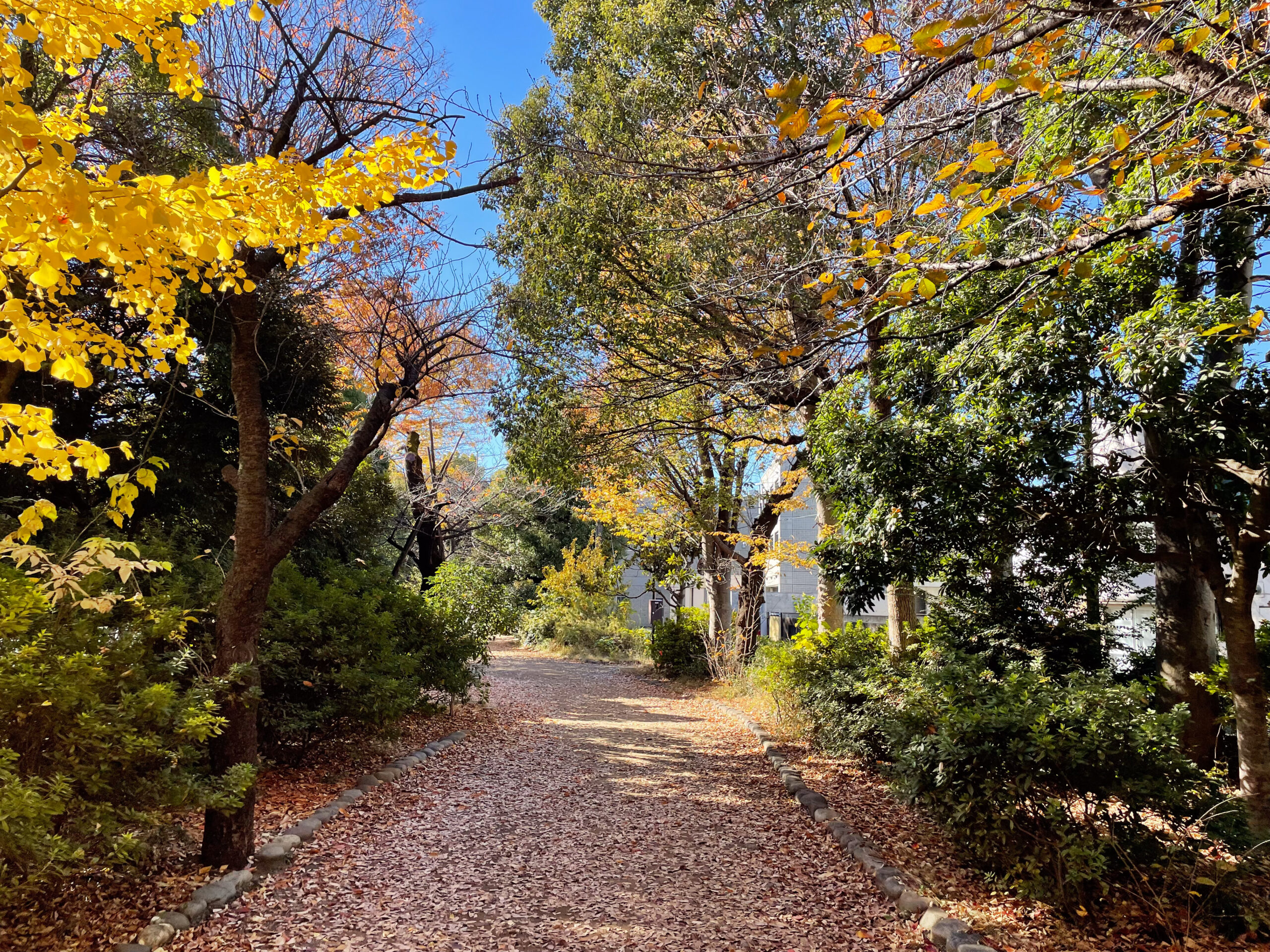
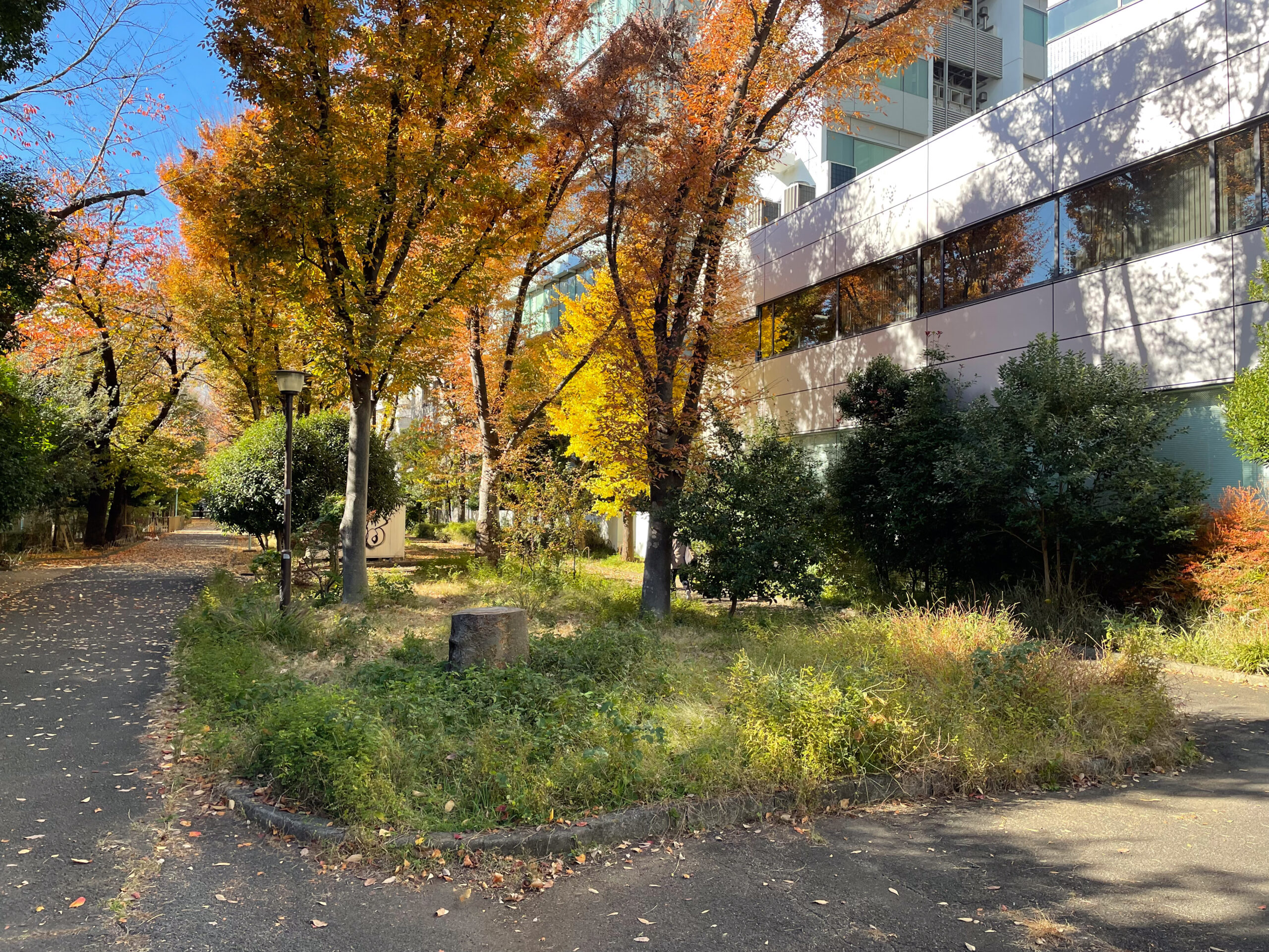
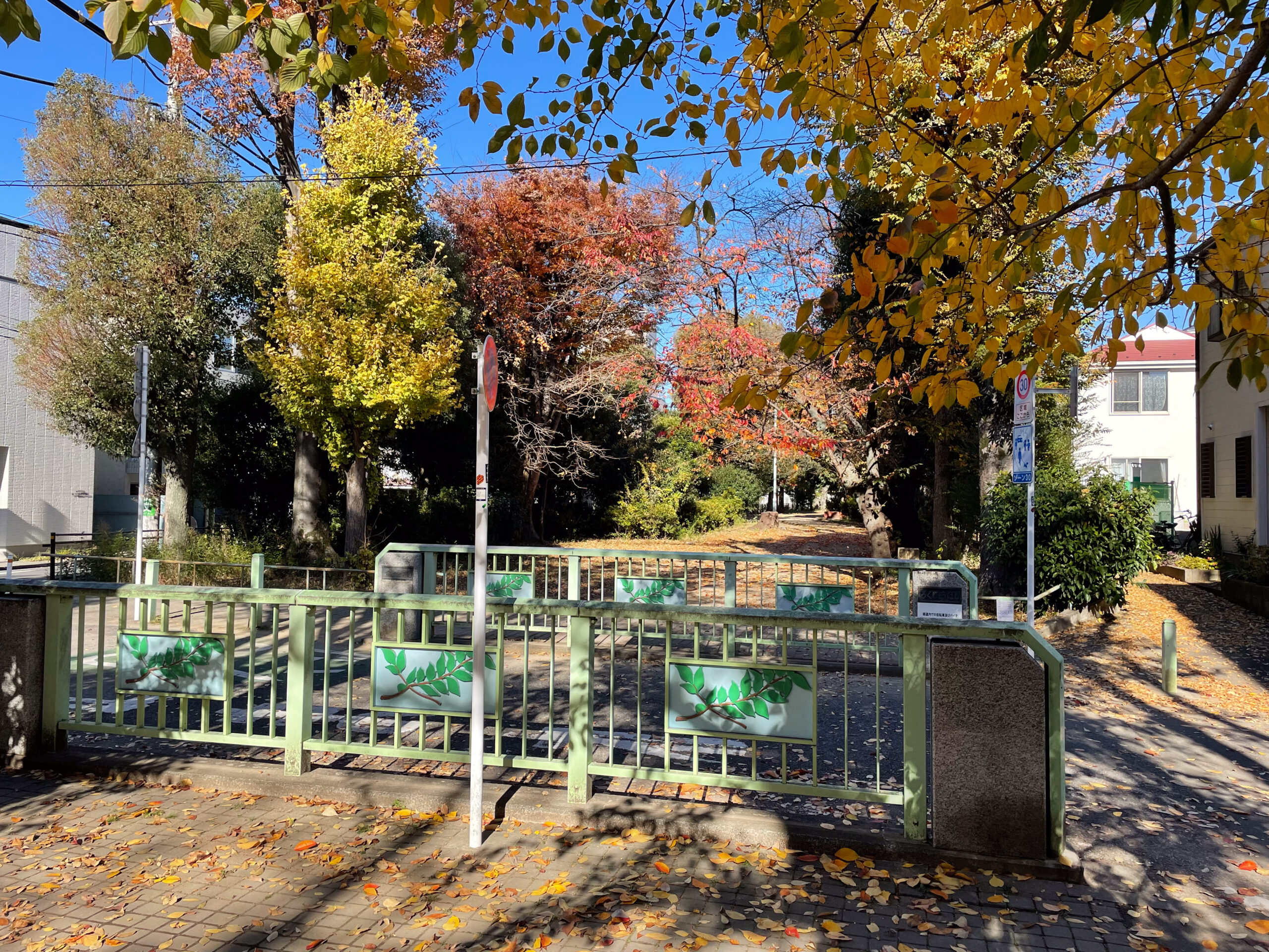
From Tenjin Bridge the path enters the Yoyogi Greenway. Yoyogi Greenway is part of a near-continuous tree-lined promenade over the former canal that snakes through Shibuya to Daitabashi.
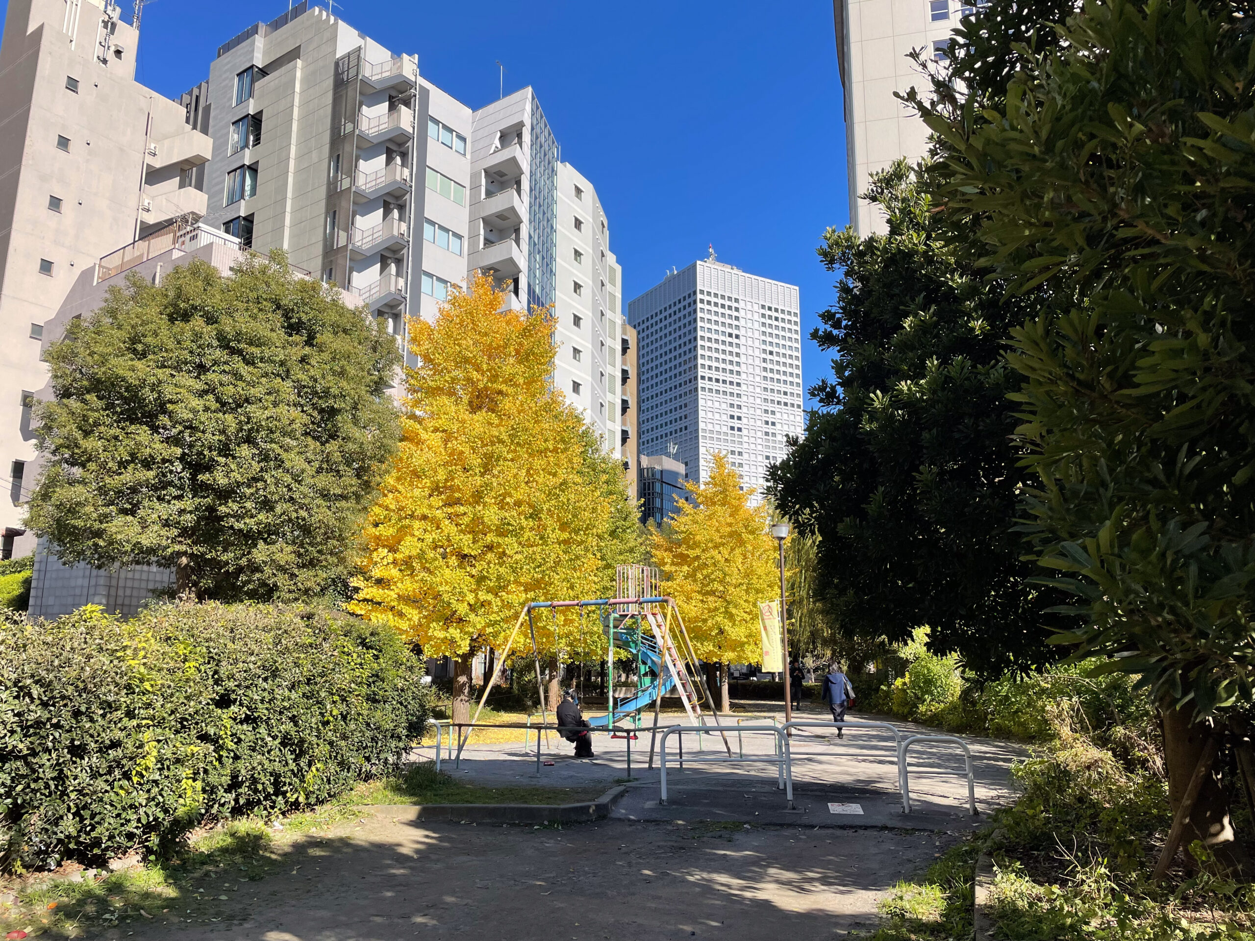
At Keio Line’s former Tenjin Bridge Station there is a small playground. I rode the swing set here the day prior, so I chose to skip it this day. Turning to photograph it with sun behind me, I found that a young woman already sat to swing, listening to headphones in the afternoon sun. I felt like I gave her a gift by waiting until the next swing set.
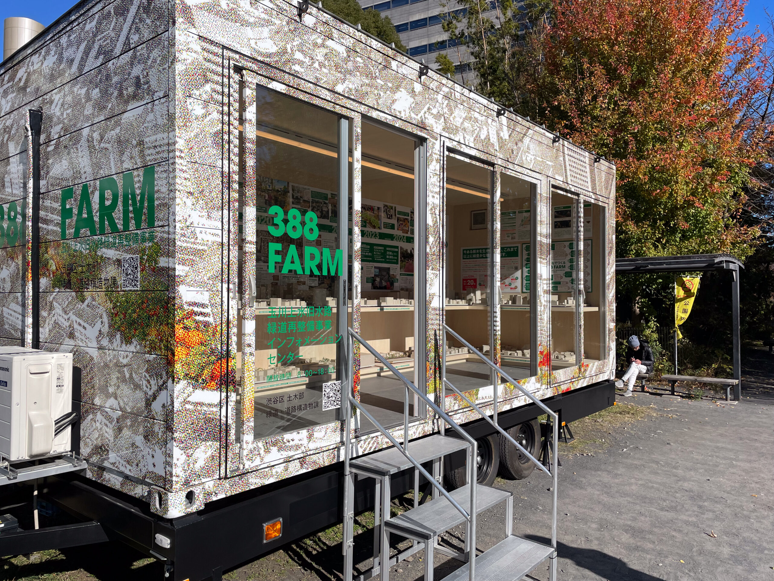
The equipment is all very old now. For a decade, city leaders deferred maintenance with expectation of rebuilding the greenway. Coincidentally, I took m walk the day of the opening of the “388 Farm Information Center” near Nishisando. It details work that is about to start here.
The small trailer is filled with architectural models of the future of the stretch of Tamagawa Aqueduct I walked to Sasazuka. Next to it there is a small demonstration patch of the pavers and vegetation that will be installed. The plan calls for replacing all of the play toys, repaving with easier to walk and more environmentally friendly materials, adding lots of trees, and creating community farms.
I happened to walk by a press conference with architect Tsuyoshi Tane the day before at the trailer, but shied away from stopping and watching. The city posted a long video of him describing the project a few days later.
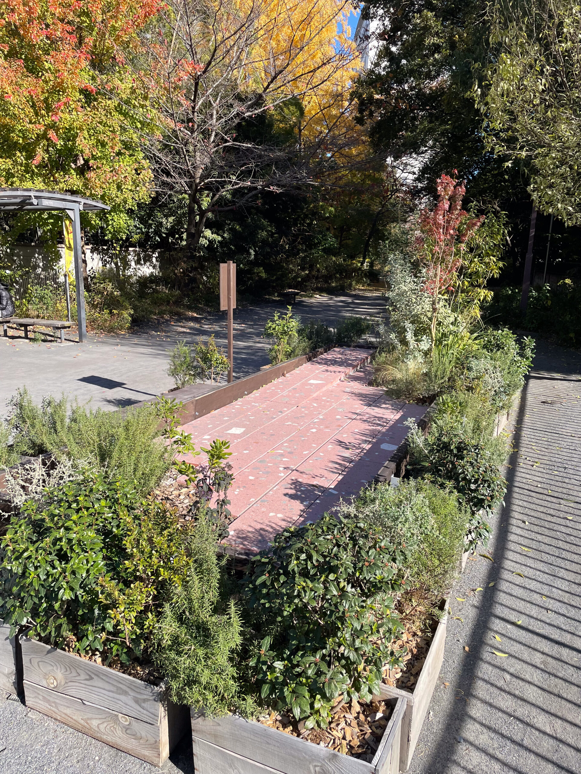
Nishisando and Yoyogi Bridge
Along with the swinger I saw folks reading, walking, staging art photos with Tarot cards (Bunka Gakuen students, presumably), and chatting in this stretch.
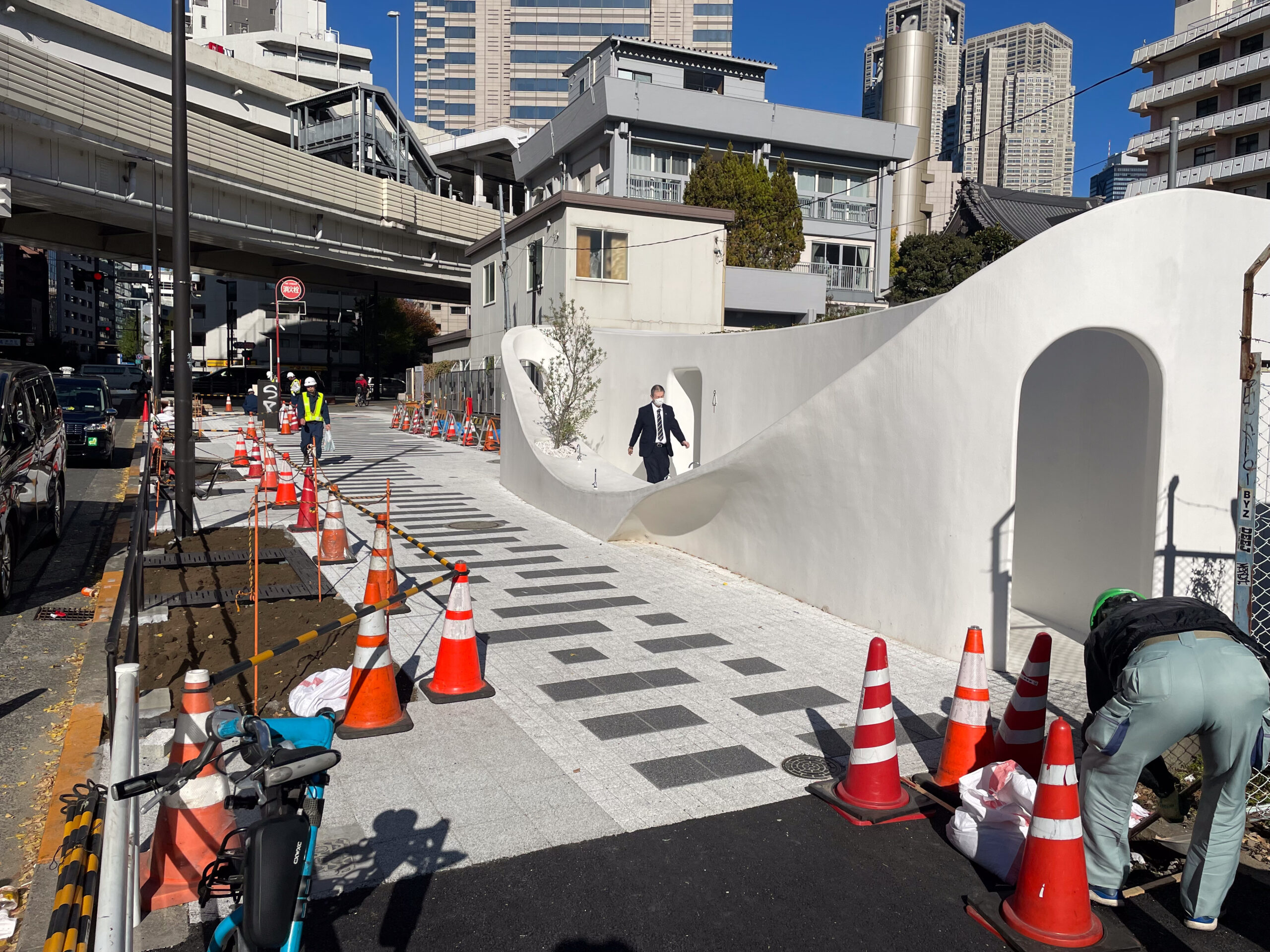
At Nishisando as I turned to cross under the wild overhead roadways of Highway 4, I spotted an equally curvaceous toilet by architect Sou Fujimoto. It was popular both with photographers and taxi drivers, who had space to park and take a quick break.
At the highway the bridge that crossed here was called Yoyogi Bridge, but there is no marker commemorating it. Instead there are the Yoyohata lanterns. I found one reference that said there was a Taicho Bridge, which perhaps linked the temple’ cemeteries on both sides of the aqueduct.
Tamagawa Aqueduct: Nishisando to Yamate Street
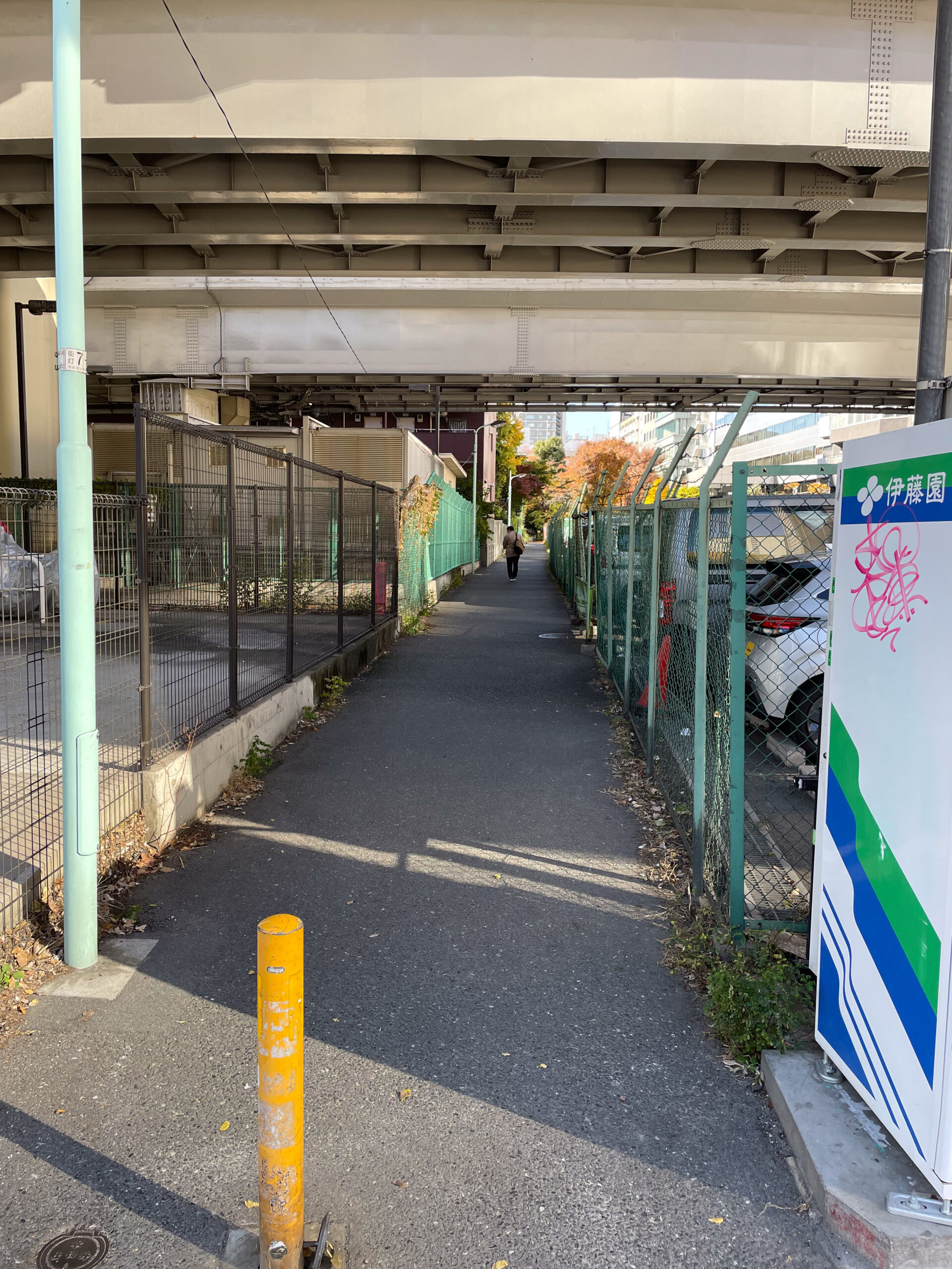
The greenway briefly disappears on the west side of the Nishisando intersection. Instead there is a parking lot under the expressway. It’s the location of a former Keio Line station. It started as Yoyogi Station in 1914, then Behind-Jingu Station for twenty years from 1919 to 1939, and finally it was Nishisando Station until 1945.
Continuing past it, the greenway suddenly restarts between buildings west of the lot. Further along it comes to an intersection with Yamate Street and more raised expressways. Just before that are the remnants of the Sanji Bridge. While most of the bridge memorials are artistic reproductions from the 80s and 90s, these railings are the real deal. Because of the railings, it’s clear here that the Keio Line ran on the north side of the canal, with the bridge on the south part of the street.
In this stretch I followed a man until he sat to eat lunch, saw a facilities employee cleaning leaves around a building, and passed a police officer among other folks strolling in from Yamate Street.
Yamate Street had a bridge crossing the aqueduct, Ito Bridge. There’s no memorial currently, but a remnant was still on the west side until 2009.

Hatsudai Greenway: Yamate Street to Hatsudai Station
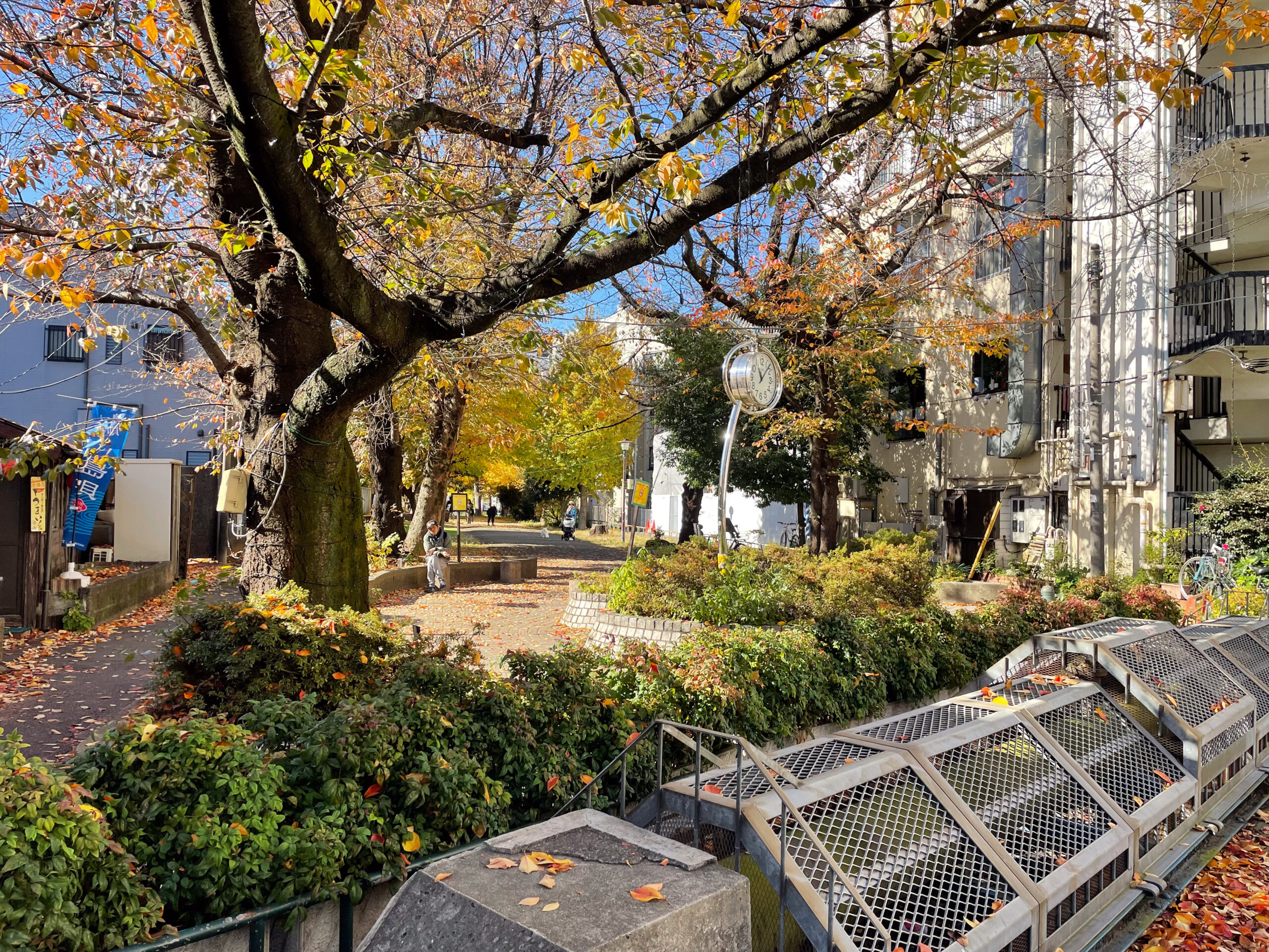
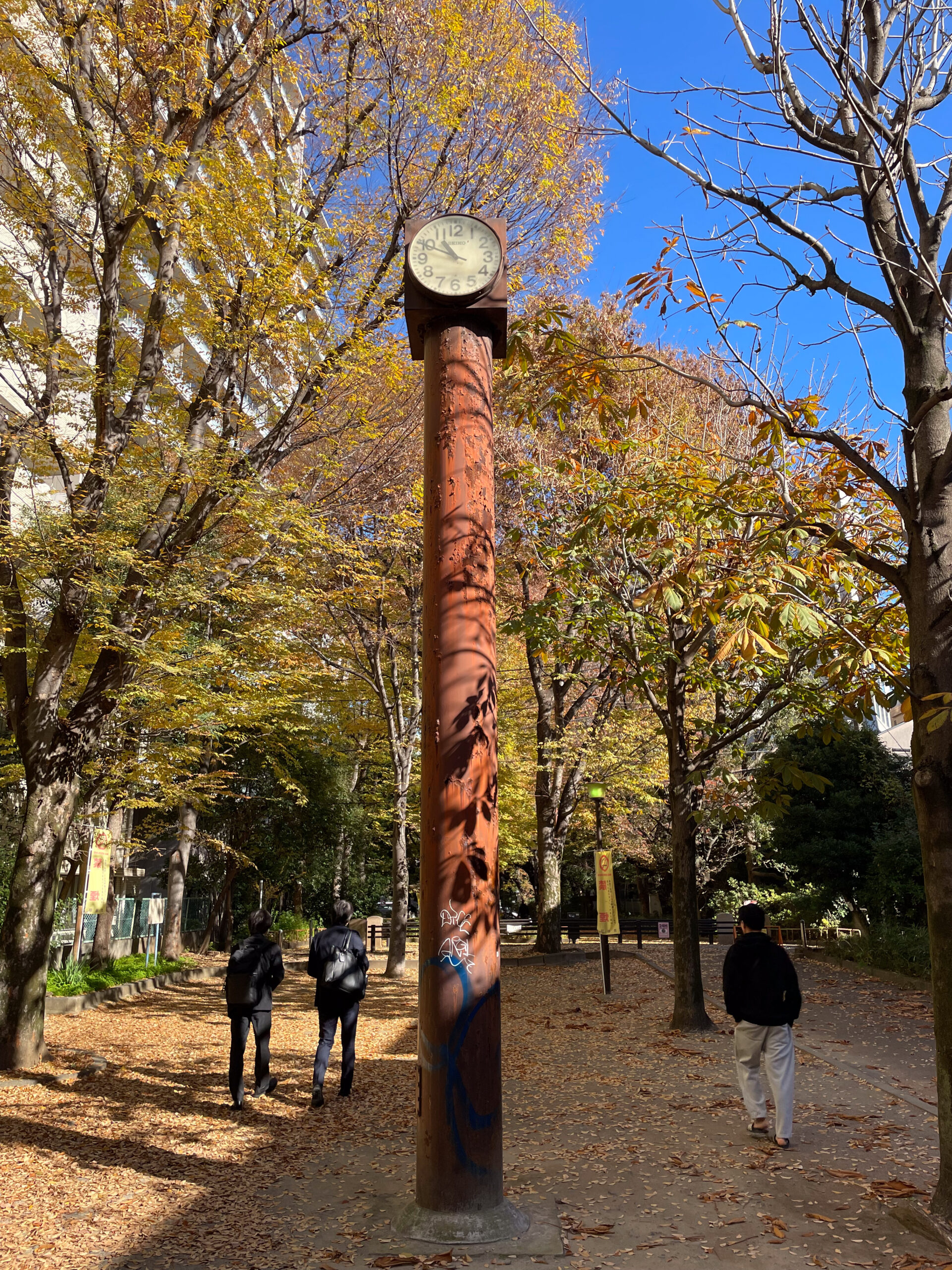
After Yamate Street the promenade picks up a dual name as the Hatsudai Greenway. Granite markers and long railings commemorating the Itouko Bridge cross the promenade. Then a shockingly large park clock juts out, perhaps on an old water pipe, its story demanding to be told.
The greenway gradually got fuller as I approached Hatsudai Station. More people walked in and through, making it more difficult to time photographs.
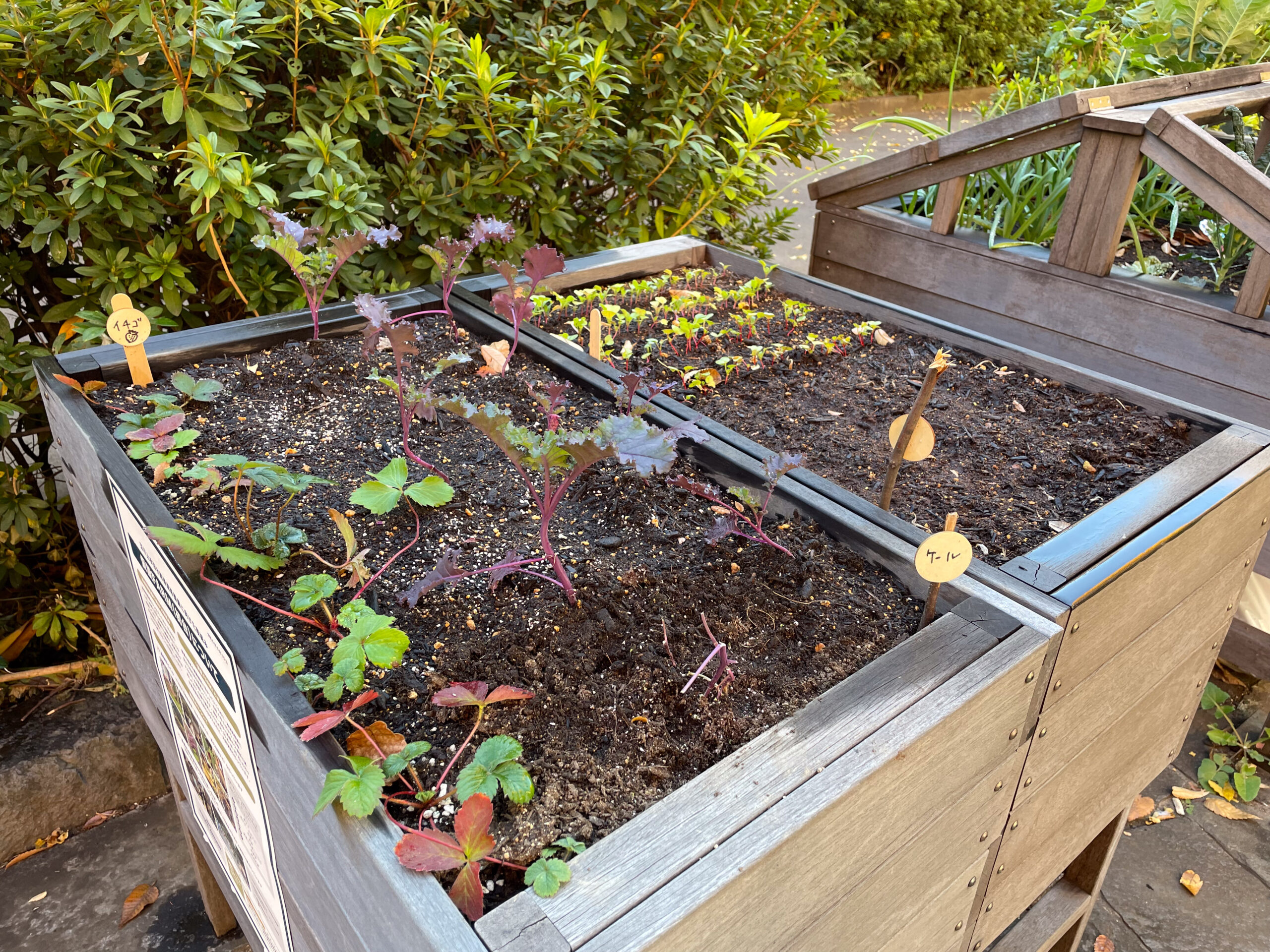
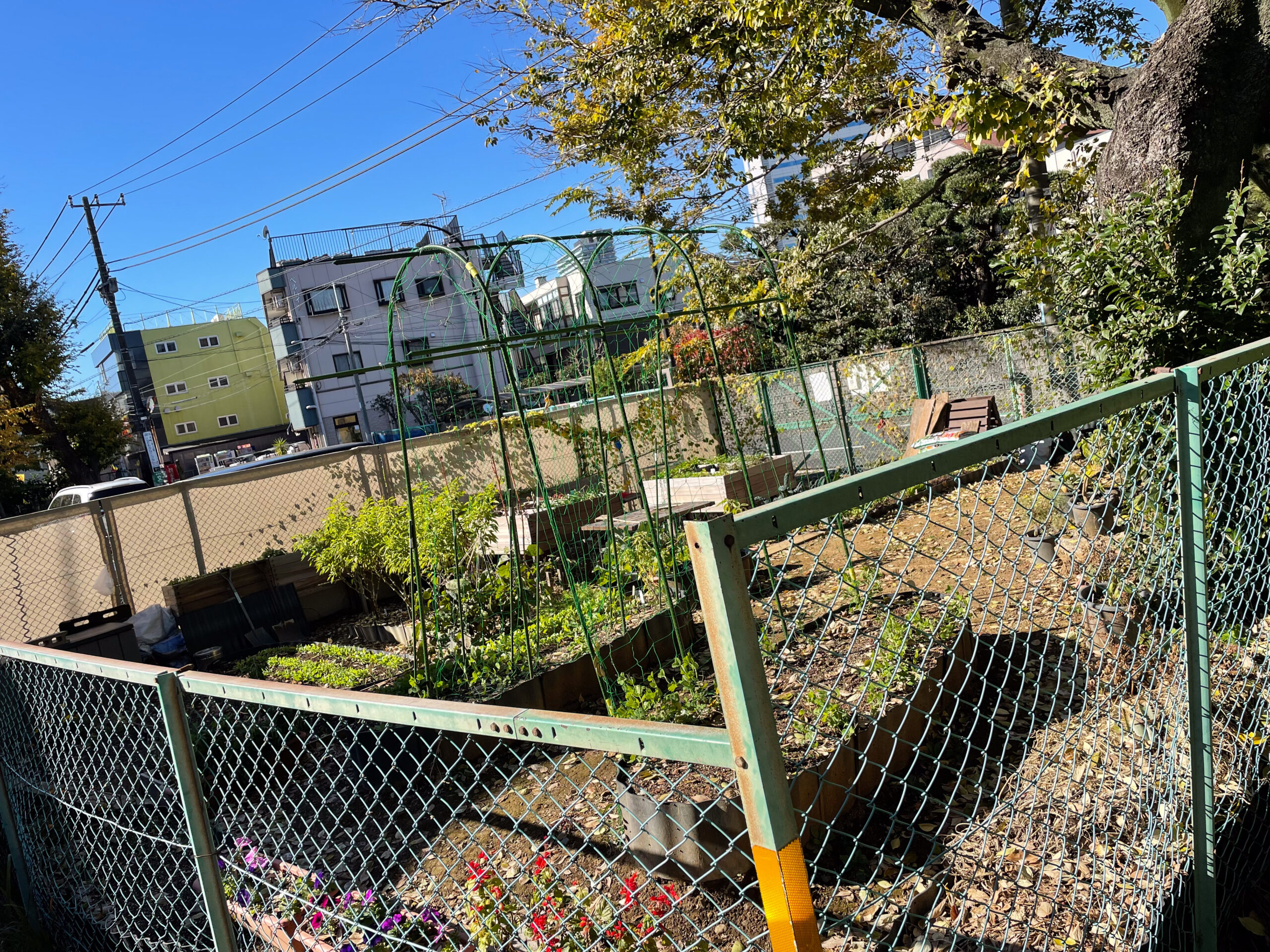
The redevelopment of the Tamagawa Aqueduct Greenway is called “388 Farm”. Farm is meant to be mostly conceptual, with the growing of community. But there will be literal community gardens with vegetable farms as well. Near Hatsudai Station is a beta test site. When I walked by a group was tending the garden.
Kaisei Bridge connected Hatsudai Station to the land south of the aqueduct.
Hatsudai Station to Honmachi 1 intersection
After Hatsudai I encountered groups of children playing in the greenway with their teachers, perhaps from the Reggio School.
One group watched a turtle brought from their classroom. Another played tag in a playground. Another marched along in line singing the Totoro theme. Yet another group ran around chasing each other in circles on a soccer field.
Just a few times a year, the children get to play in a reminder of the Tamagawa Aqueduct. It’s open late July to late September, but only on the first and third Wednesdays from 9am to 4pm.
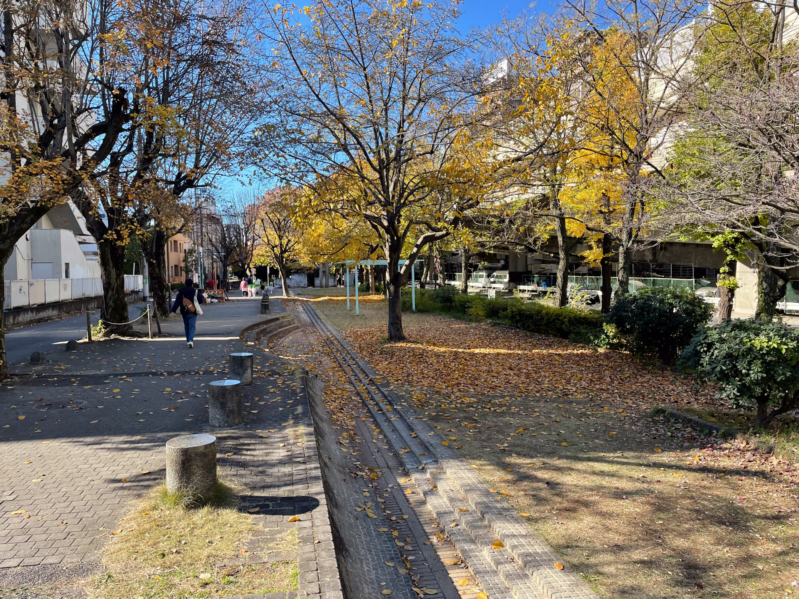
Water flows from a sculpture which looks like exiting the mouth of a pipe. It then flows in a narrow channel along the side of the greenway, between short steps and a slope. This opens a bit right next to a play area with ancient, cute toys.
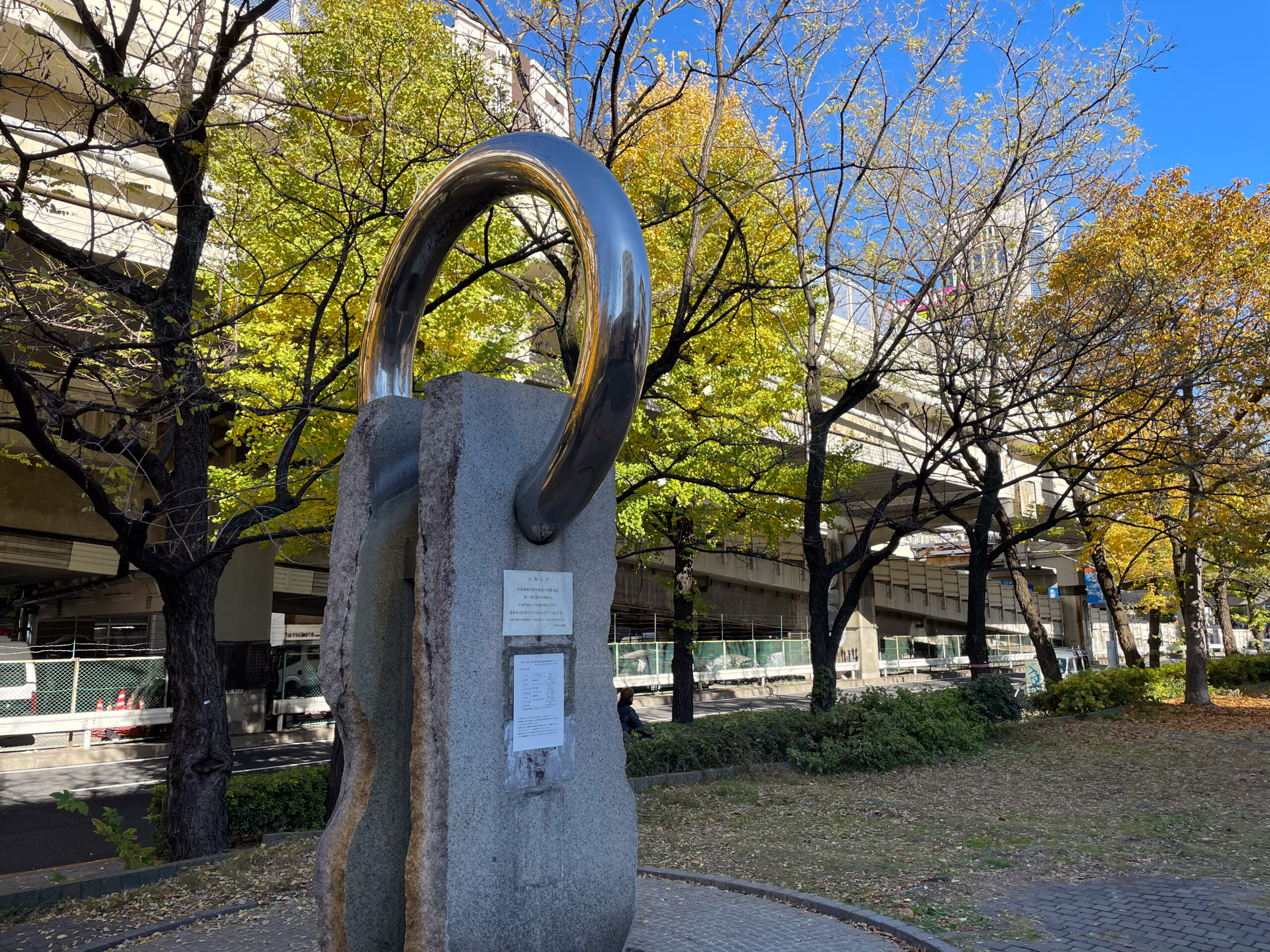
Just after the play area is a monument to Daiemon Bridge. At Honmachi 1 intersection we pass by the former Shin-Yoyohata Bridge. There is no marker for it, but it’s mentioned on many Tamagawa Aqueduct walking sites and is even present on the Shibuya City GIS road maps.
Nishihara Greenway: Honmachi 1 to Setagaya-doori
After the Honmachi 1 intersection, the aqueduct begins a long, meandering southward curve, far from the Koshu Highway. The local name of the linear park becomes the Nishihara Greenway.
For thirty years, though, this was primarily a surface rail line for Keio Line. Then in 1964 Keio finished underground reconstruction of the line from Shinjuku to Hatsudai. West of Hatsudai the rails stayed above ground until 1983. After the undergrounding the Keio Line to just east of Sasazuka, city planners created the series of parks and promenades of the Former Tamagawa Aqueduct Greenway that we have been walking on.
The former path of the Keio Line splits away here, parallel to the Koshu Highway, and first the Keio New Line and then the Keio Line emerge into that space after nearby Hatagaya Station.
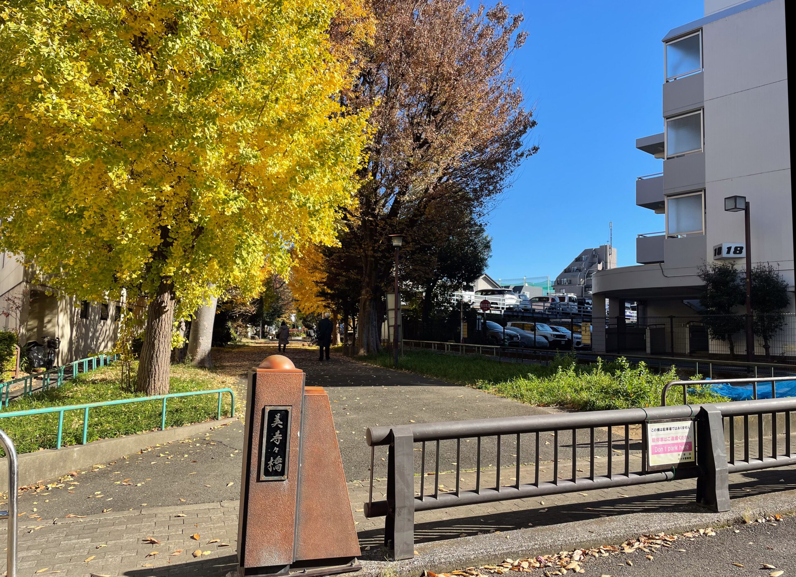
The Nishihara Greenway features a number of memorials to former bridges. In order they are Shindai Bridge, West Yoyogi Bridge, Niji Bridge, and Misusu Bridge.

Hatagaya Greenway: Along Setagaya-doori
After Setagaya Avenue comes alongside the former aqueduct, the local name changes to Hatagaya Greenway.
A rich array of bridges continue in this section. In order they are Yamashita Bridge, Yoyohata Bridge, Aioi Bridge, Tokiwa Bridge, Rokujo Bridge, Gojo Bridge, Yonjo Bridge, and Kitazawa Bridge. Between Yoyohata and Aioi bridges, there’s a larger beta site for 388 Farm community garden.
Rokujo, Gojo, and Yonjo bridges have interesting names. They mean 6th, 5th, and 4th Lane bridges. The neighborhood east of the bridges is a relatively rare grid, so the lanes must be counting from Inokashira Avenue. I wonder if these lanes were suburban development along Inokashira Avenue, maybe just after the Great Kanto Earthquake in 1923.
I’d really like to see a sign or post with a one or two sentence description of the history of each bridge with things like this. They would say what we know about when each bridge was built, and what is the meaning of the bridge’s name.
Kitazawa Bridge was a crossing for Setagaya Avenue itself, as the Tamagawa Aqueduct turns and heads back north.
Tamagawa Aqueduct: Setagaya-doori to Sasazuka Station
We exit Shibuya City and enter Setagaya City after crossing Setagaya Avenue. With the change in cities, we lose all of the historical markers for past bridges. If I wished there were more information in Shibuya, then here in Setagaya I wish there were any recognition at all.
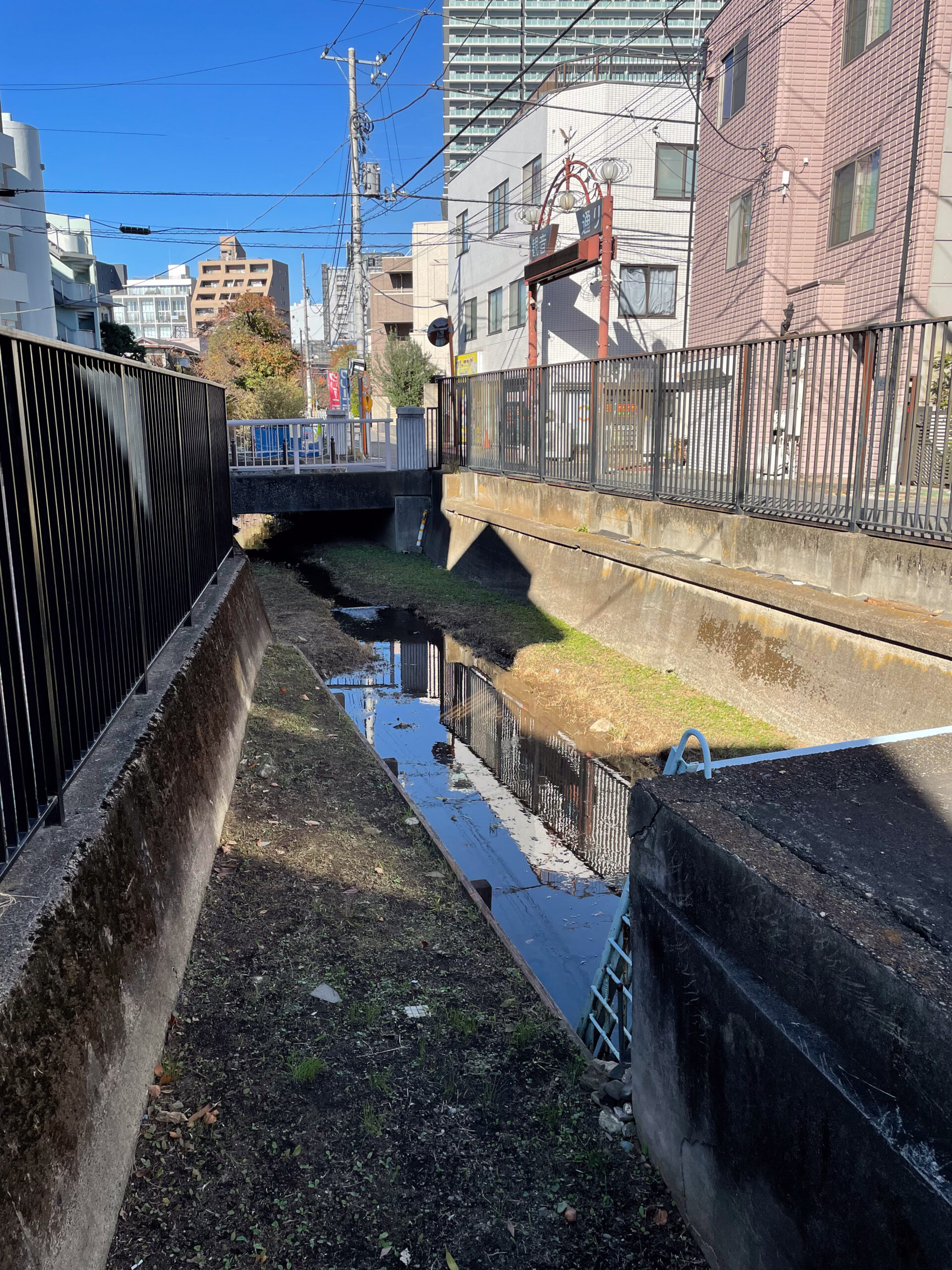
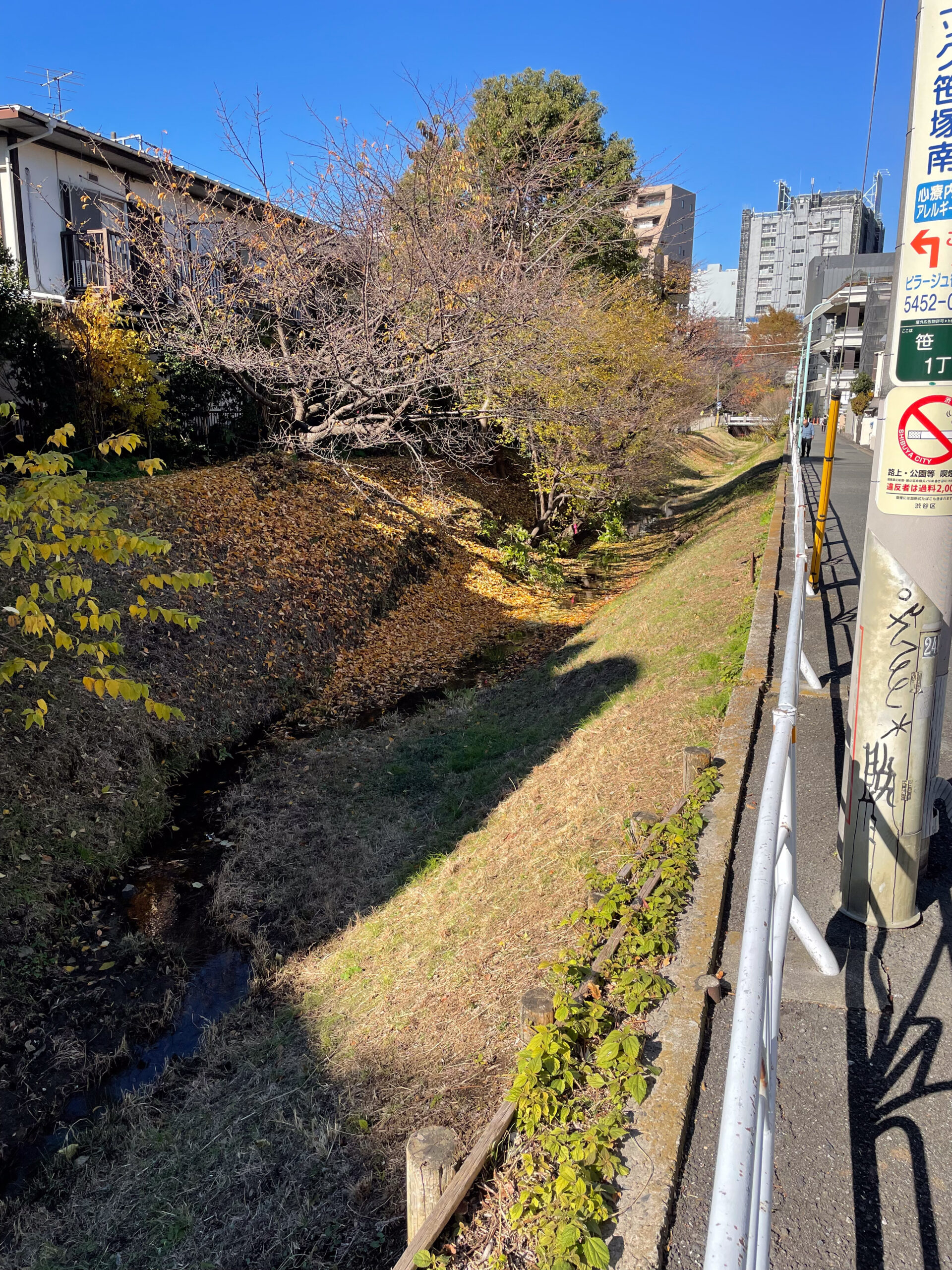
After a long stretch of blacktop with a few trees, though, I came to the best part of the walk. For a short stretch before Sasazuka Station, the Tamagawa Aqueduct ditch breaks into view. It starts at the intake for the former Mita Canal at Sasazuka Bridge, which is a real, honest bridge. Through this canal, Tamagawa Aqueduct supplied water for Ebisu Beer for many years. I believe this open air section continued to function as an aqueduct until the Mita Canal finally shut down 1974.
Travelling along the open ditch we next come to Third Bridge (Daisango-bashi). Shortly after that the water exits another grate, after traveling underground from the green space north of Shimo-takaido Station.
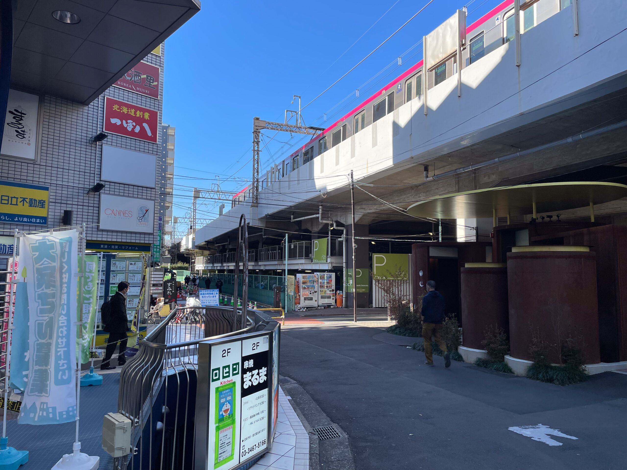
At Sasazuka Station there is another Tokyo Toilet, this one designed by Junko Kobayashi. Shibuya City has built sixteen designer toilets in all. Just beyond Kobayashi’s toilet is a set of historical markers for Minami Don-don Bridge, the last one I saw on the walk.
Last thoughts
It’s exceedingly rare to walk somewhere that no one has before, or to travel land completely unchanged by human hands. And yet it’s equally rare to know the story, or one of the stories, behind the route. So, I’m delighted each time I discover how the path I’m on came to be. As an example, last year I enjoyed learning the history of trails I hiked hours from Seattle on National Parks land with no cell service in the North Cascades. But the closer you get to the center of a city, the more change there’s been and the more stories left behind. As a city of city centers, Tokyo heaps up change in layer after layer, and digging through them reveals ever fainter echoes of what once was here.
I hope that the bridges of Tamagawa Aqueduct take an even more prominent role in architect Tsuyoshi Tane’s new design for Shibuya’s linear park. Likewise, I hope Setagaya and other cities celebrate the history of the aqueduct and all it meant for the development of Edo.
Other reading like Tamagawa Aqueduct walking
- Part one, Aoi Bridge: Tokyo walking
- Akasaka on the Rise: in 2006 I researched, photographed, and wrote about the historic streets of Tokyo’s Akasaka neighborhood in a section of my old website.
- Photos on walks in Tokyo from 2000-2008. In particular I’ll highlight Streetcar Memories, describing the route of the number 38 Jyoto-sen toden streetcar; Walk to Work 4, from Higashi-Koenji to Shinjuku; and Urban River Cycling, from Mitaka to Akasaka-Mitsuke.
- I’ve done some rephotography around Tokyo, including at Tameike, Tokyo’s water source before Tamagawa Aqueduct.
- Rephotography in Nikko
- Rephotography in Utsunomiya
- Walking off into the Sunset: a history hike of landmarks in Seattle’s Capitol Hill neighborhood reviewing the book Seattle Walks (Capitol Hill Seattle Blog)
Discover more from ba-kground
Subscribe to get the latest posts sent to your email.

