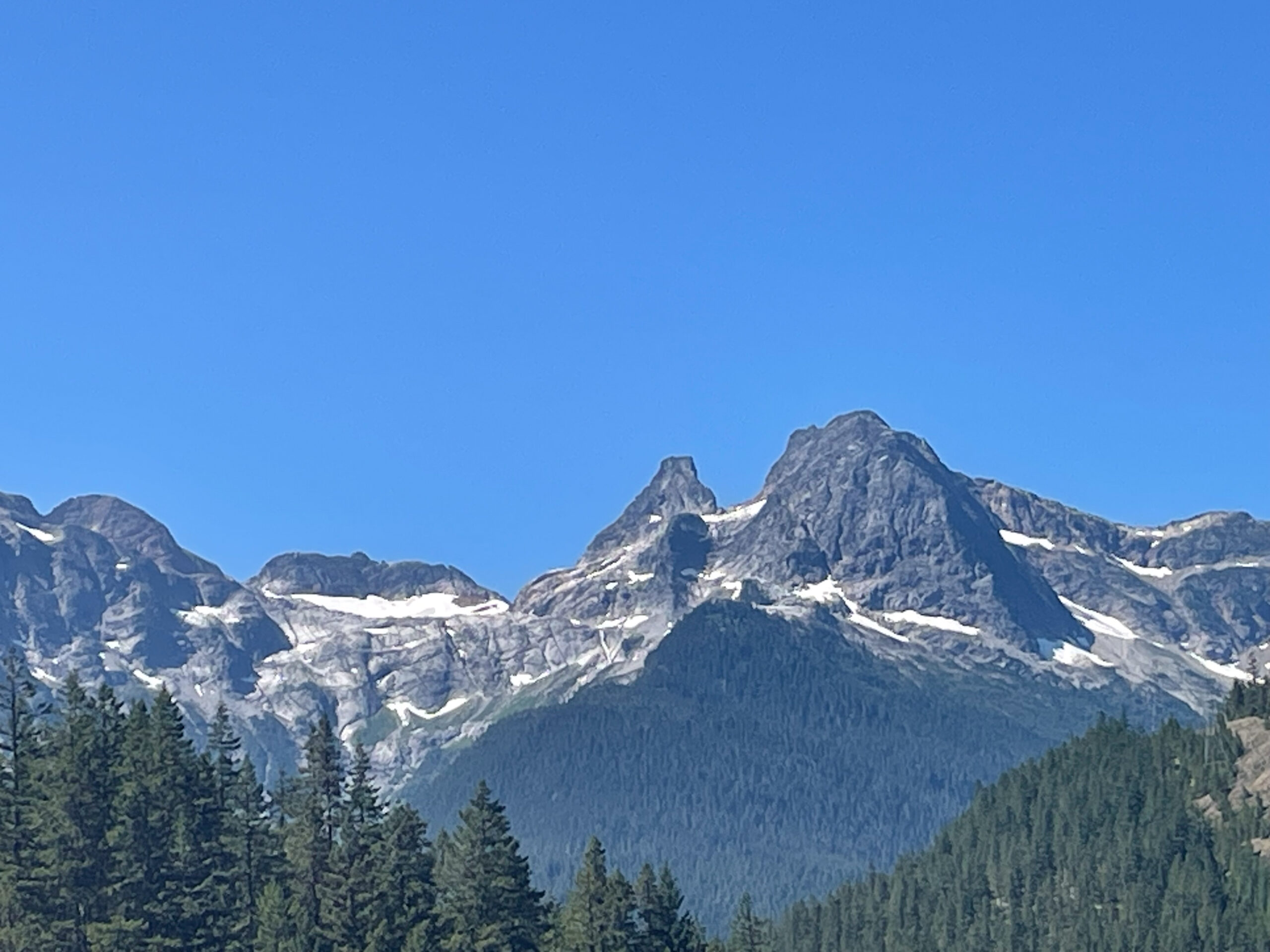
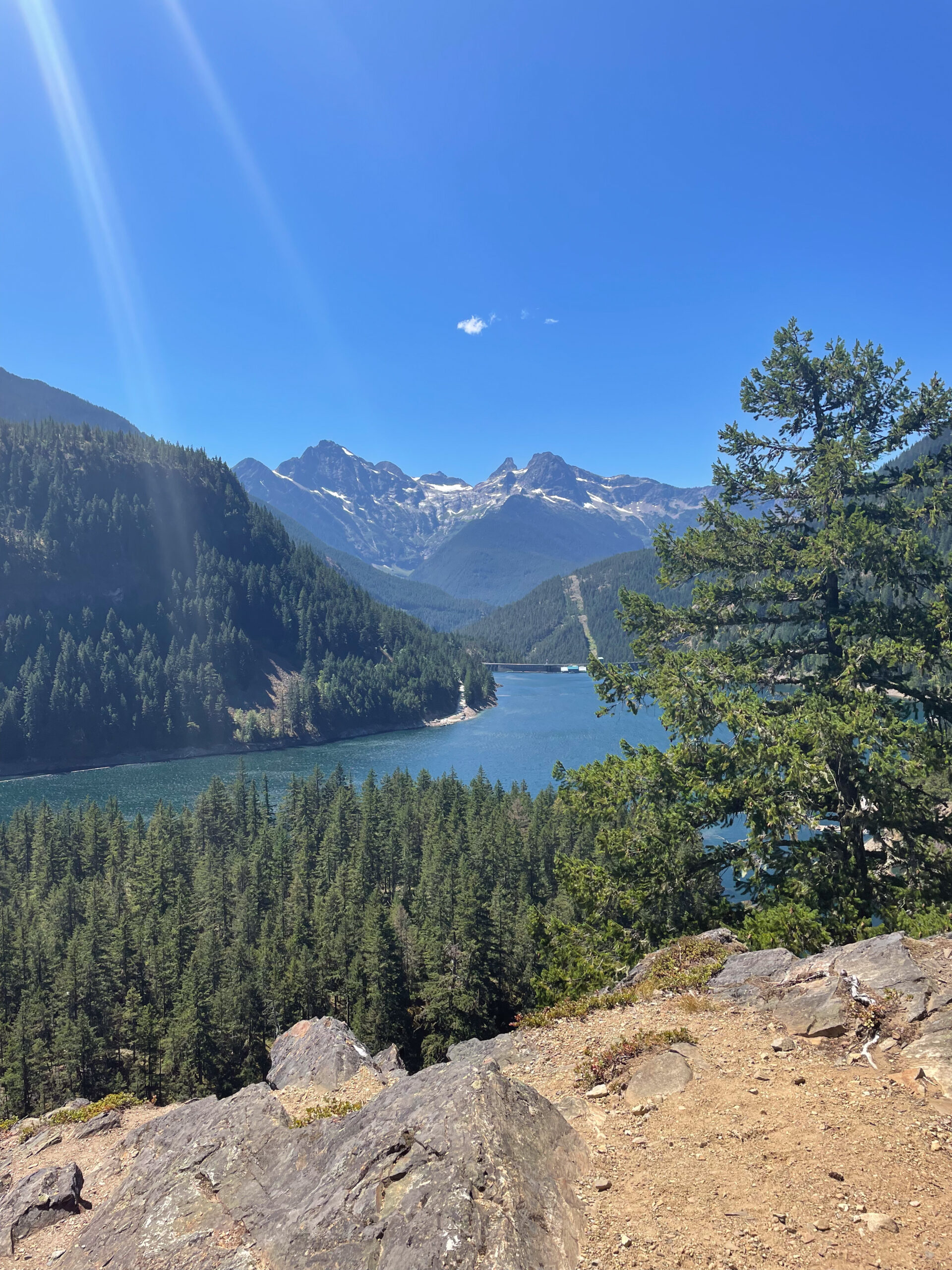
I saw Paul Bunyan’s Stump. The giant lumberjack left it behind when he cut down the huge trees of Washington State, in what is now North Cascades National Park.
In 2023 I hiked down from Ross Dam Trailhead, where you can see it well from Highway 20. The view is best from the dam, though, after dropping 500 feet and out to the middle of the wide, high dam. It’s fitting, because you will say “dam” and other choice words as you swear like a lumberjack back up the hill.
How they grew Paul Bunyan’s Stump
Paul Bunyan came to Washington in the early- or mid-1910s, probably. He started felling timber in Wisconsin in the 1880s. After clearing the forests there with his crew, he made his way west. Along the way he created the Grand Canyon by dragging his axe. In 1924 James Stevens wrote his book Paul Bunyan here about the guy, so we know Paul was in western Washington by then.
Stevens’ book had a story called “Oratorical Medicine”. In it, Stevens related a few facts about Paul’s activities. For example, Paul’s crew dug Puget Sound originally as a grave for Babe the Blue Ox. They all thought he was dying, but luckily they were wrong. They left the excavated dirt lying around, and that is now the Cascade Mountains.
So, I guess that this tree must have grown up on top of that dirt. To think how tall it was, and how fast it got there… The stump stands at 7,513 feet, almost a mile and a half. The tree must have been ten miles high! I’m sure there must be an astonishing tale of where that pine cone came from, and of its fertilizer. I suppose that after Babe ate a ton of grain for lunch each day, there must have been tailings left over from his digestive extraction of resources.
Those tailings — excretions or perhaps even excrement if you will — would make fertile soil for sure.
Origin of Paul Bunyan’s Stump’s name
Paul Bunyan’s Stump’s official name recording came on September 10, 1979 into USGS data. But USGS maps from 1963 labeled it already. In its data, USGS says that the originator of the name was the US Forest Service.
However, I believe the name dates from the late 1930s, and from someone working to build Ross Dam.
The first mention in Seattle newspapers that I can find is from 1946. That makes it unlikely that it originates from the miners that came to the area in the late 1800s and early 1900s. I think papers would talk about it sooner.
It’s also possible that it was a Forest Service employee who named it, as the USGS data might imply. The Forest Service managed this area, the Washington Forest Reserve, before it became a national park in 1969. They needed to check in on the mining claims, I guess, so they came out on occasion.
Where to see Paul Bunyan’s Stump
Moreso than time, though, place is the key piece of evidence to me.
When I first learned of the stump I tried looking at it from various Google Maps street views, and in photos taken of adjacent peaks. It just looked like a rock, especially up close. That was until I viewed it in photos from the top of Ross Dam. Seattle City Light built the first phase of Ross Dam in the late 1930s, which sounds just about right for the name to enter public conscious in the mid-1940s.
This area was incredibly remote until then. It was difficult to get here, and I wonder if there were any clear viewpoints for the Forest Service rangers along the Skagit River before that.
The stump is also visible now from Highway 20 near the Ross Dam Trailhead. But I don’t think there was a road here until the 1960s.
To recap, I know it’s visible from a line that includes the trailhead, Ross Dam, and the bluff above Green Point camp. Points northeast of that like Jack Mountain and Devil’s Dome must have a view as well.
So, I strongly believe the naming of Paul Bunyan’s Stump came during the construction of Ross Dam by one of the workers. Unfortunately, unlike what we know of Paul Bunyan, I don’t have direct evidence to back up my story of who named Paul Bunyan’s Stump.

Further reading
- Blue Ox Camp, Seattle’s Paul Bunyan camp
- Finding Mount Jennings
- Seattle’s Beacon Hill, Redefined
- Was Seattle named Duwamps?
Discover more from ba-kground
Subscribe to get the latest posts sent to your email.


