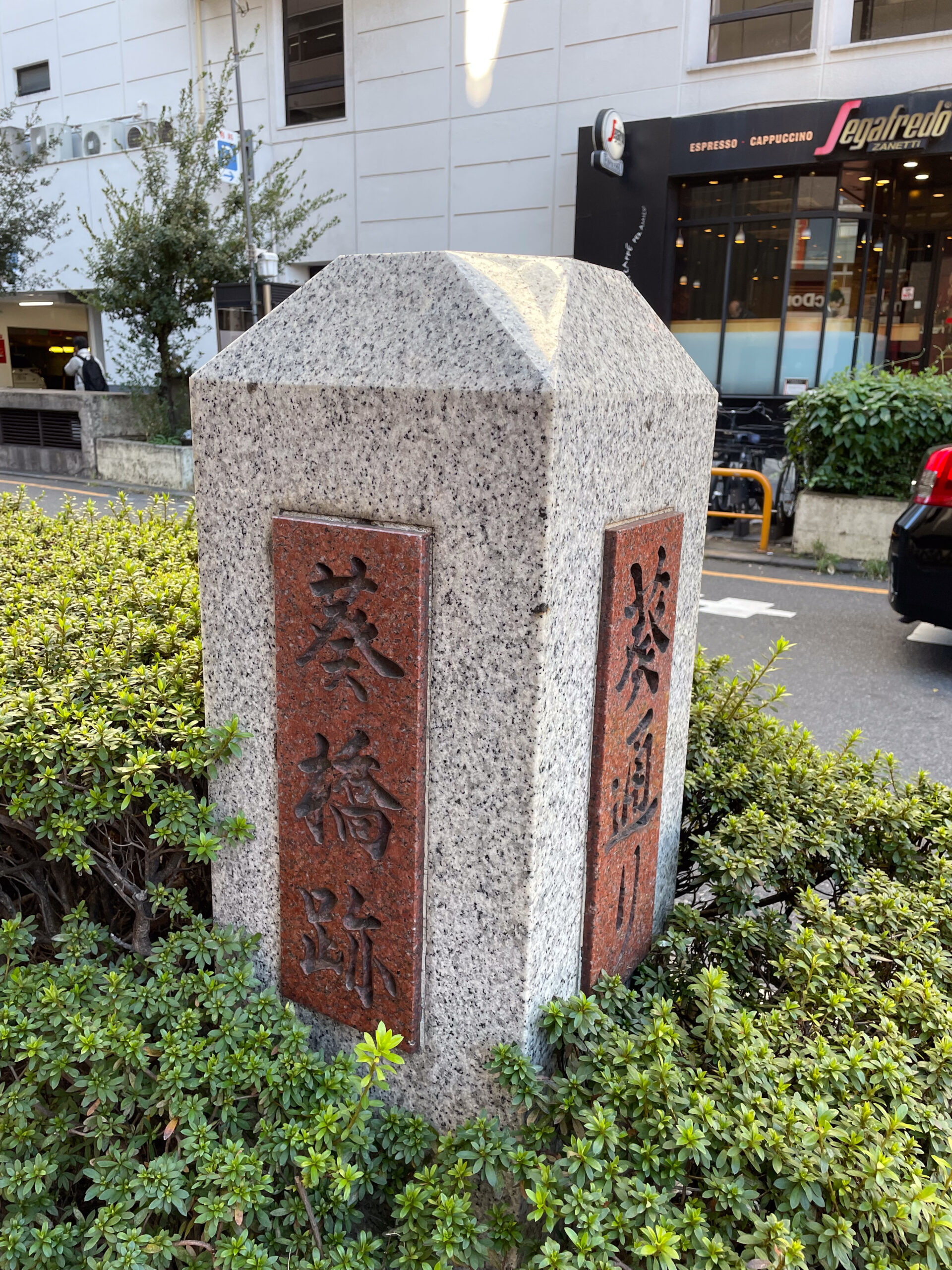
Recently I walked in Tokyo from Shinjuku to Sasazuka on the old Tamagawa Aqueduct, starting at Aoi Bridge. It was certainly a refreshing break from Shinjuku’s bustle, and felt like walking through the backyards of Shibuya’s north edge neighborhoods. I’m sharing it so that you can set out and create your own memories of the sights and sounds of the city, past and present.
I’ll break this into two parts: first a focus on my starting point and downstream to Edo Castle; and then the upstream route I walked.
Tamagawa Aqueduct
Tamagawa Aqueduct, or Tamagawa jōsui (玉川上水), began supplying water to Edo in 1653. It supplemented the canaled Kanda River, which brought water west from Inokashira Pond. As the castle town of Edo grew and more people needed even more water, Kanda quickly became insufficient. So the 27-mile Tamagawa Aqueduct channeled water from the Tama River (多摩川) way out in the foothills at Hamura City. That is next to Yokota Air Force Base, between Tachikawa and Ome in far western Tokyo Prefecture.
The aqueduct brought needed drinking water, and it also powered water wheels and irrigated new farms on the Musashino plain. After Mitaka it ran not far, and sometimes very close, to the Kanda River’s canal.
Surely a hike from the aqueduct’s east end at Yotsuya all the way out to Hamura would be fantastic. And it would be a long walk, just a tad over a marathon in length. But this time I took just a 3-mile section. I started at the last vestige west of the Shinjuku Station tracks, to the exposed waterway near Sasazuka Station. Altogether, it took me about two hours to walk, inspect signs, and take an express Keio train back to Shinjuku.
In this article I’ll focus on my starting point, Aoi Bridge, and talk about the part east of it that I didn’t cover in this walk. Then in part two I’ll describe the walk itself and changes coming to the aqueduct walking path.

Aoi Bridge
Our exploration of the aqueduct begins at a bridge with no water.
The name Aoibashi (葵橋) means “Hollyhock Bridge”. I’ll refer to it as Aoi Bridge for readability. The hollyhock flower was the family crest of the Tokugawa family, who ruled Japan as shoguns during the Edo period from 1603 to 1868. It ended when rebel forces toppled the Tokugawa military and government after years of attempts.

Displaced from their palace, the Tokugawa families left Edo Castle and bought up farm land to build new residences in the early Meiji period. The main family bought land south of what’s now JR Sendagaya Station. And the Kii Tokugawa, who formerly ruled Wakayama, bought the land which is now the JR Tokyo General Hospital, per the area neighborhood business association. But that was redeveloped recently, and the land now also includes the JR Minami Shinjuku Building and Maynds Tower.
Aoi Bridge spanned the Tamagawa Aqueduct from Koshu Highway towards the Kii Tokugawa estate. It’s on the road leading to Yoyogi Station, which is called Yotsuya Tsunohazu Line.
Every road needed a small bridge across the Tamagawa Aqueduct, and west of Hatsudai Station there are many memorialized with markers and bridge forms on land. But near Shinjuku I only found a couple remnants or descriptions, despite other bridges visible on maps and in old aerial photographs. I think this one is remembered because of the train lines that eventually hid the aqueduct from us here.
Aoi Bridge Station
Upheaval for the aqueduct came with urbanization, starting in the early Meiji period in 1885. Construction of one of Japan’s first train lines cut across it, coming from Shinagawa north through Shibuya and Shinjuku. That is now part of the JR Yamanote Line. A few decades later private rail companies began expanding residential Tokyo out into the Musashino plain: Seibu, Tokyu, Keio, Musashino, Odakyu, and other railways and tramways.
In 1915, Keio Railway finished their first passenger rail line with a section between Sasazuka and Shinjuku on the Koshu Highway (甲州街道). Unlike today, their terminal was originally off to the east of JR’s Shinjuku Station. At first a streetside stop, they soon built a terminal building, currently the Keio Oiwake Building with IKEA. So for transfers, Keio had stops on either end of their long rail bridge across Odakyu and national railway tracks. On the southwest corner of Shinjuku Station, Keio called their stop Aoi Bridge Station.
Aoi Bridge Station served Shinjuku for just 10 years, from 1915 until 1925. In 1925, Tokyo replaced the original wood bridge over the tracks with a wider steel bridge. Keio created a new station on the deck of the bridge at the south exit of Shinjuku Station, eliminating Aoi Bridge and Station Front stations.

What runs under Aoi Bridge
Twenty years later, American air raids during World War Two destroyed Keio’s nearby electric substation. Suddenly, Keio needed to shorten the line and stop crossing JR on the raised bridge. Shinjuku had free space on the west side along Odakyu’s tracks, held for an expected extension of Tokyu’s Toyoko Line. Due to the emergency, Keio built a new station there instead and cut off the south exit station and Oiwake.
With increasing car traffic, Keio moved its trains underground in in 1963. The first phase submerged Keio Shinjuku Station and brought tracks under Tamagawa Aqueduct from Bunka Gakuen at Nishi Shinjuku 2 intersection. The Keio Line remains today directly below Aoi Street.
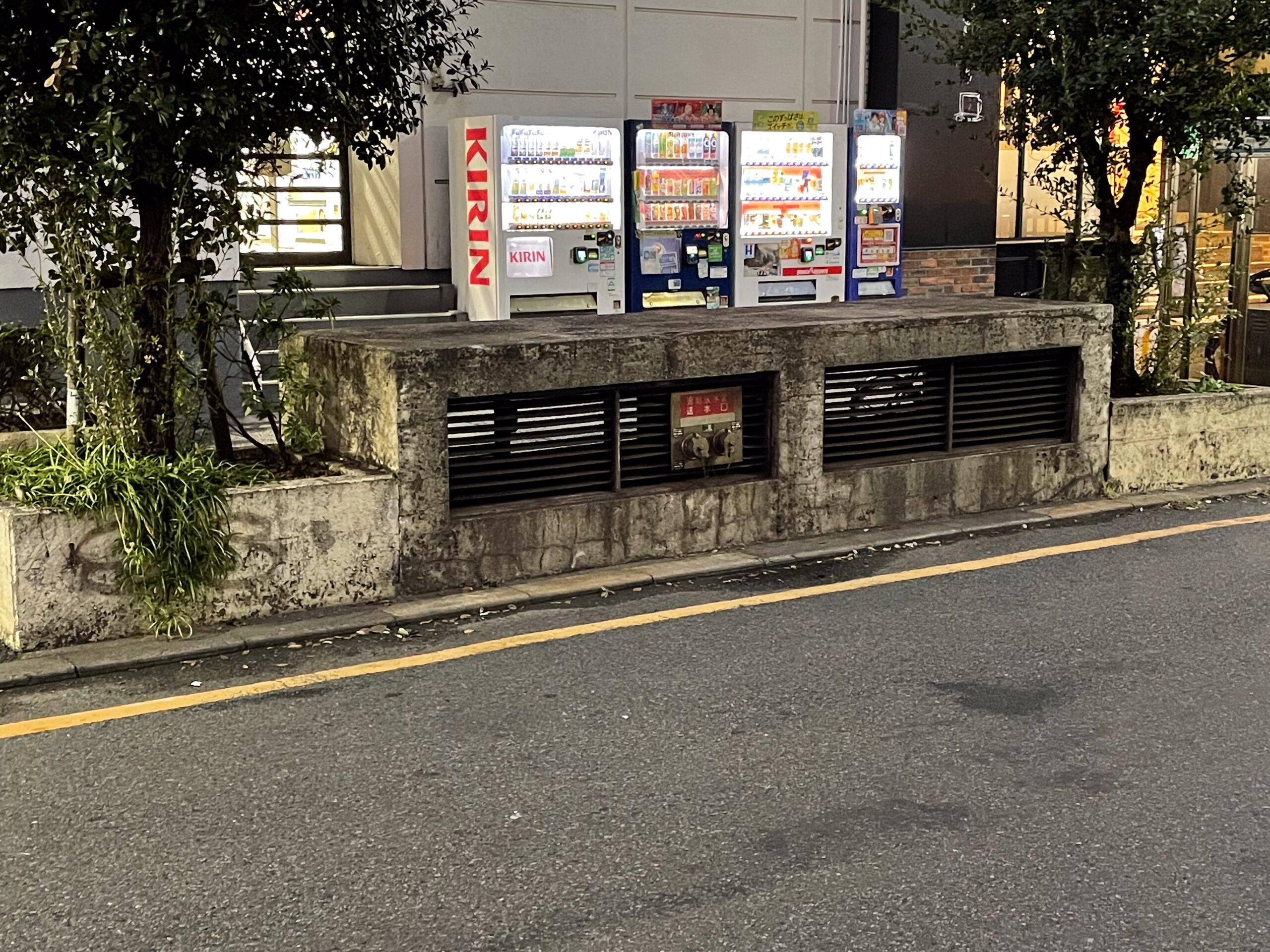
Standing at the Aoi Bridge markers you can hear the sound of Keio trains rushing by underground, echoing out of a vent amid bushes on the north side of the street. So where Aoi Bridge once crossed Tamagawa Aqueduct, we now have a street crossing over the Keio Line.
Aoi Bridge to the Past and Future
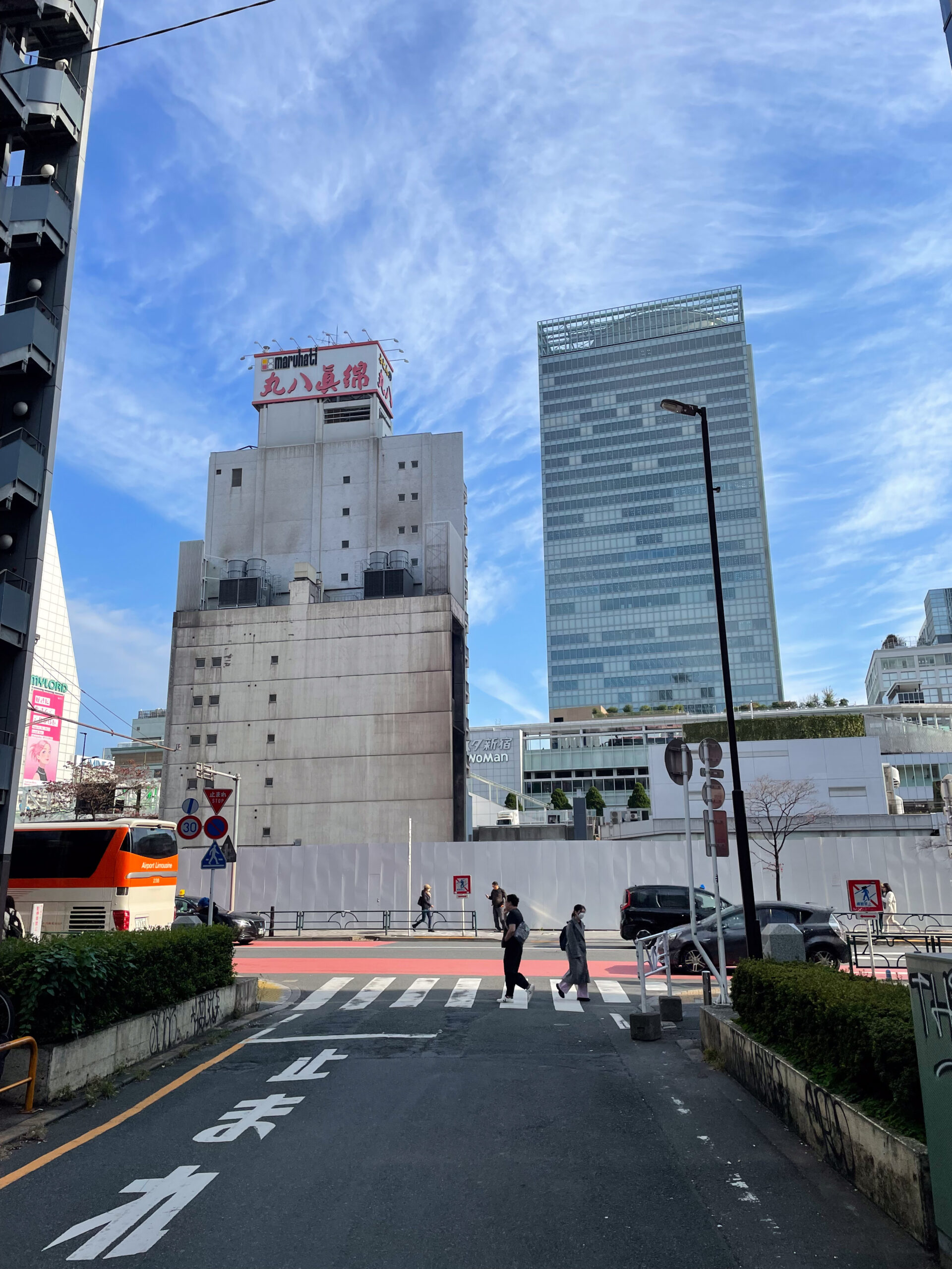
Looking east from the Aoi Bridge memorial markers, there is currently an empty construction site for an upcoming 65-story tower. It’s part of Shinjuku’s “Southwest Entrance”. That is a joint project between JR and Keio, the next phase of the reimagining of Shinjuku Station. Until recently, there was a short 8-story commercial building here with an underground garage for Toyota Rent-a-Car. Called the Tokyo South Shinjuku Building (東京南新宿ビルディング), it had an office of the Tokyo Bureau of Waterworks in between beauty salons and classrooms.
The Bureau of Waterworks had a plaque there, a memorial of Tamagawa Aqueduct. One aqueduct walker posted clear photos to their blog post in 2019. The sign text began fancifully, “Once upon a time, Tamagawa Aqueduct flowed over this land…” The plaque said that the residents of this area in the early 1900s were students, artists, and writers. It also told the final end of the Tamagawa Aqueduct. It came when Bureau of Waterworks decommissioned the Yodobashi Purification Plant in 1964. This then completely cut the aqueduct off from Tokyo’s fresh water.
Redevelopment caused demolition of the Tokyo South Shinjuku Building from 2023 to 2024. But with it gone, we get a clear view of the aqueduct’s former path. It angled a bit north, abutting and then running alongside the Koshu Highway starting about where the Miraina Tower is now. We can’t see it on or under the ground, but now, for just a short time, we can see its path in the air.
So, Aoi Bridge is an imaginary bridge over the Keio Line, and it’s a metaphorical bridge to the past and future of Shinjuku.
Aoi Bridge in pop culture
As a metaphor, Aoi Bridge found some pop culture prominence in 2020. Aoi Bashi was the title of the ending theme to an anime called Sing “Yesterday” For Me (イエスタデイをうたって) by singer-songwriter Sayuri. Although it’s usually written in romaji, sometimes the song title is mistranslated Blue Bridge instead of Hollyhock Bridge, mistaking a homonym.
The lyrics describe a scene on a west-bound platform in Shinjuku Station, and mention heading to a would-be-lover’s part time job. The song was written specifically for the anime, which takes place in Shimo-kitazawa. In a PR announcement by Sony Music, Sayuri described the origin of the song’s name. It came not from the bridge itself but from the old Keio Line station at Shinjuku a block away. I imagine that in the lyrics she stands on the Keio Line platform, about to head under Aoi Bridge for a transfer at Meidaimae.
Sayuri went on to say “I’d love if everyone could, through my song, enjoy the view in front of them knowing it is a mixture of history and memories that can no longer be seen.” That’s exactly the point of my writing as well. And unfortunately I have to share that mix of history and memories now includes Sayuri herself. She recently died after suffering chronic illness. It was just a few months before I visited Aoi Bridge.
Heading downstream
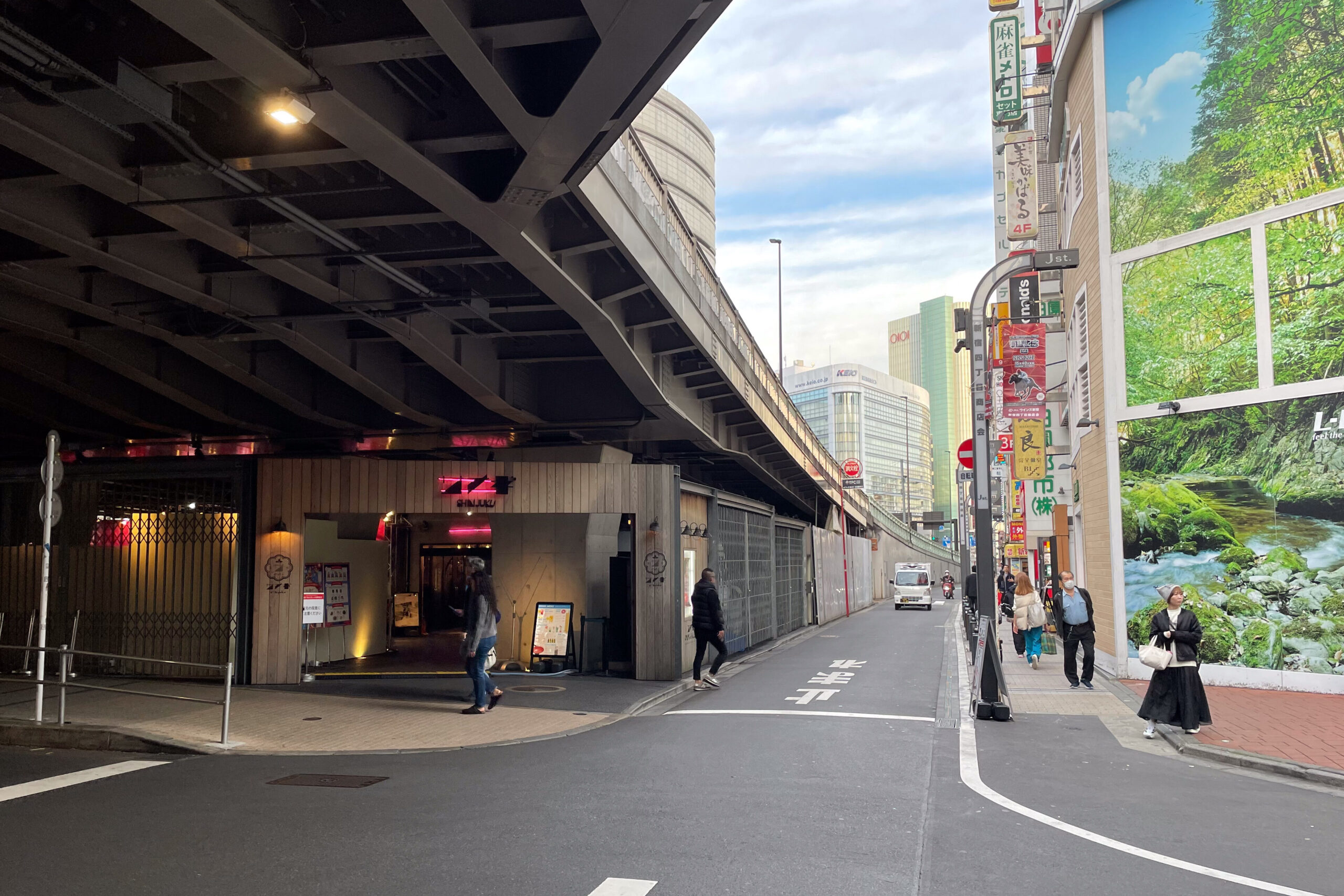
Flowing down the canal to Miraina Tower and continuing on, Tamagawa Aqueduct ended not far away in Yotsuya. It hugged the south side of Koshu Highway, in the little side road below the raised highway deck at the station. Then it skirted along the north of what is now Shinjuku Gyoen, formerly the Naito daimyo estate.
The exposed aqueduct ended at a spot called Yotsuya Okido (四谷大木戸), or Yotsuya Great Wood Gate. This was owing to a stone wall with gate that guarded Edo Castle between Yotsuya post station and Naito new post station or Naito Shinjuku. Shinjuku means “new post station”, and it was the area just north of Shinjuku Gyoen.
At Yotsuya Okido the aqueduct entered stone and wood pipes that took it to various places around Edo. There is a monument to the Okido at the Yotsuya Community Center at the intersection of Koshu Highway and Old Koshu Highway. That signifies the end point of the aqueduct. Overflow ran into Shibuya River, which became a navigable waterway with the Tamagawa Aqueduct’s construction.
The gate and exposed aqueduct represented the westmost edge of Edo. Now the capital of Tokyo is even farther west, and just a few landmarks like Aoi Bridge give a hint at what was here. Hopefully architects and planners keep those landmarks in mind as they erase the Shinjuku we know and create an all-new landscape.
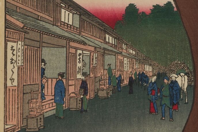

That’s it for part one. Next, experience more Tamagawa Aqueduct past and future along the borderlands of Shinjuku and Shibuya as I walk to Sasazuka.
Related writing
- Part two, Tamagawa Aqueduct: Tokyo walking
- Akasaka on the Rise: in 2006 I researched, photographed, and wrote about the historic streets of Tokyo’s Akasaka neighborhood in a section of my old website.
- Photos on walks in Tokyo from 2000-2008. In particular I’ll highlight Streetcar Memories, describing the route of the number 38 Jyoto-sen toden streetcar; Walk to Work 4, from Higashi-Koenji to Shinjuku; and Urban River Cycling, from Mitaka to Akasaka-Mitsuke.
- I’ve done some rephotography around Tokyo, including at Tameike, Tokyo’s water source before Tamagawa Aqueduct.
- Rephotography in Nikko
- Rephotography in Utsunomiya
- Walking off into the Sunset: a history hike of landmarks in Seattle’s Capitol Hill neighborhood reviewing the book Seattle Walks (Capitol Hill Seattle Blog)
Discover more from ba-kground
Subscribe to get the latest posts sent to your email.


